Little Lost Creek
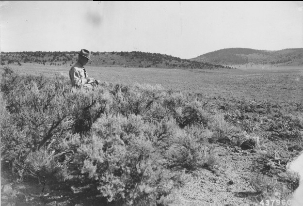
1945
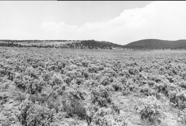
2000
Description:
Plate 219. LITTLE LOST CREEK 1945-2000 Viewed northeast up Yopa Swale. The valley bottom was root-plowed and reseeded in 1943, but not the area in the foreground. Sagebrush has since reinvaded the treated area until today there is no apparent difference between the untreated and the formerly treated sites. Pinyon and juniper have also increased except where pushed or burned - - photo left center.
Photo Information:
U.S. Forest Service photo 437960 taken in 1945; retake by Charles E. Kay on July 30, 2000 - - Photo No. 4651-1;Original photo held by the Forest Service Regional Office Photographic Collection housed at Weber State University, Ogden, UT.
Vegetative Community:
Sagebrush, Pinyon, Juniper
Location:
South Central: Section 18, Range 1 E, Township 24 S; UTM 427600 E, 4286200 N; elevation 7,090 ft.