Little Lost Creek
1944
2000
Description:
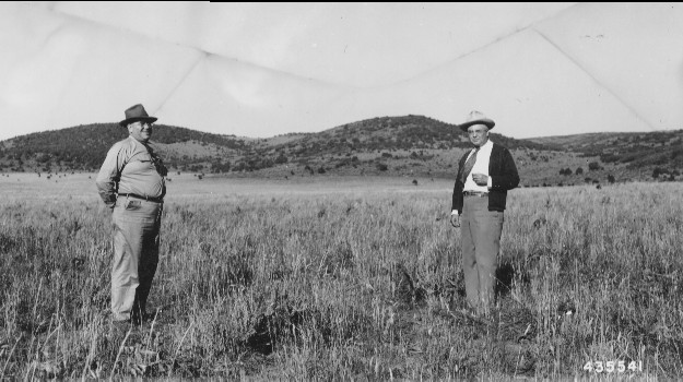
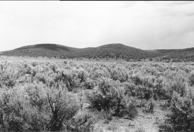
Plate 217. LITTLE LOST CREEK 1944-2000 The area in the foreground was root-plowed and reseeded in 1943 to eliminate sagebrush and to enhance the growth of grasses and forbs. Viewed northeast up Yopa Swale and Cowlay Draw from USFS Road 051. Sagebrush has since reinvaded the site seriously reducing forage production. Pinyon, juniper, and oakbrush have all increased on the distant hillsides.
Photo Information:
U.S. Forest Service photo 435541 by Blaine Betenson on September 15, 1944 - - pictured are Senator Abe Murdock and Grant Tolton; retake by Charles E. Kay on July 30, 2000 - - Photo No. 4649-17; Original photo (2200 Fishlake-11) held by the Forest Service Regional Office Photographic Collection housed at Weber State University, Ogden, UT
Vegetative Community:
Sagebrush, Pinyon, Juniper, Oakbrush
Location:
South Central: Section 17, Range 1 E, Township 24 S; UTM 428300 E, 4286600 N; elevation 7,100 ft.