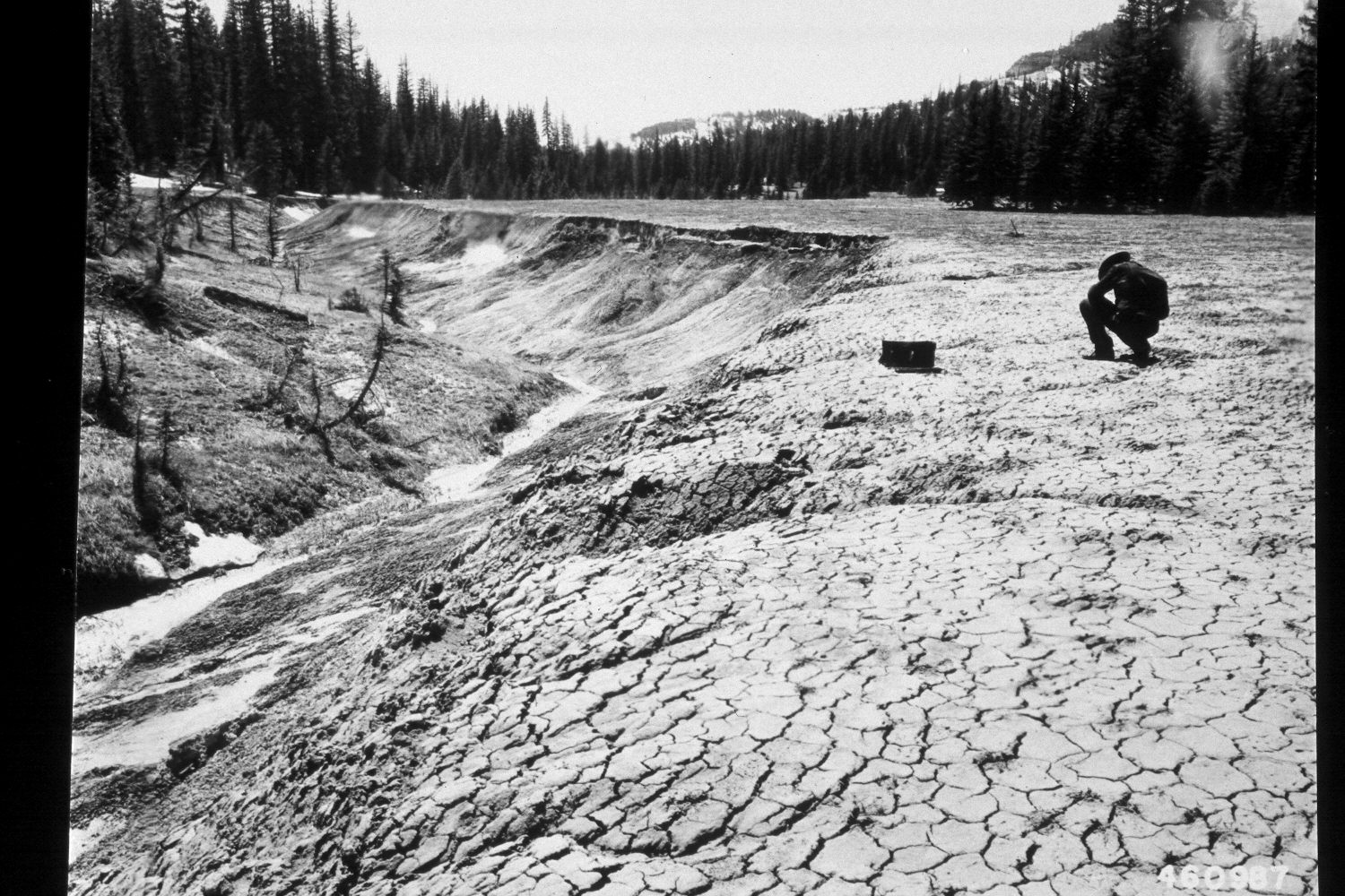
Left Fork Of Blubber Creek
1950
2003
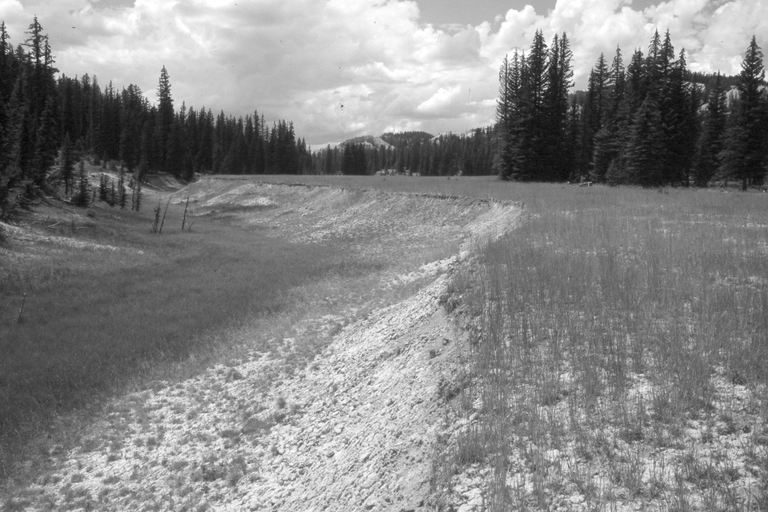
Description:
Plate 289X. Left Fork of Bubber Creek 1950 - 2003 Viewed southwest up the Left Fork of Blubber Creek on the Paunsaugunt Plateau. According to the caption on the original image, some soil erosion and small gullies occurred on this site prior to 1900, while most of the downcutting and headwall erosion took place during the early 1920s. The site was in very poor condition in 1950, but today most erosion has stopped. The stream channel has naturally revegetated with sedges, while the uplands were reseeded with intermediate wheatgrass by the Forest Service. All the larger spruce trees in the original image have been logged, nevertheless spruce and other conifers have increased. This area was actively being grazed by cattle in 2003.
Photo Information:
U.S. Forest Service photograph (460987) taken on April 24, 1950; retake by Charles E. Kay on August 7, 2003 - - Photo No. 5227-6. Original photograph held by the Utah Historical Society, Reed W. Bailey Collection (Box 11), Salt Lake City, UT.
Vegetative Community:
Riparian, Dry Meadow, Conifer
Location:
South West: Section 34, Range 4½ West, Township 37 South; UTM 383900E, 4155700 N; elevation 8,140 ft.