Kingston Canyon
1872
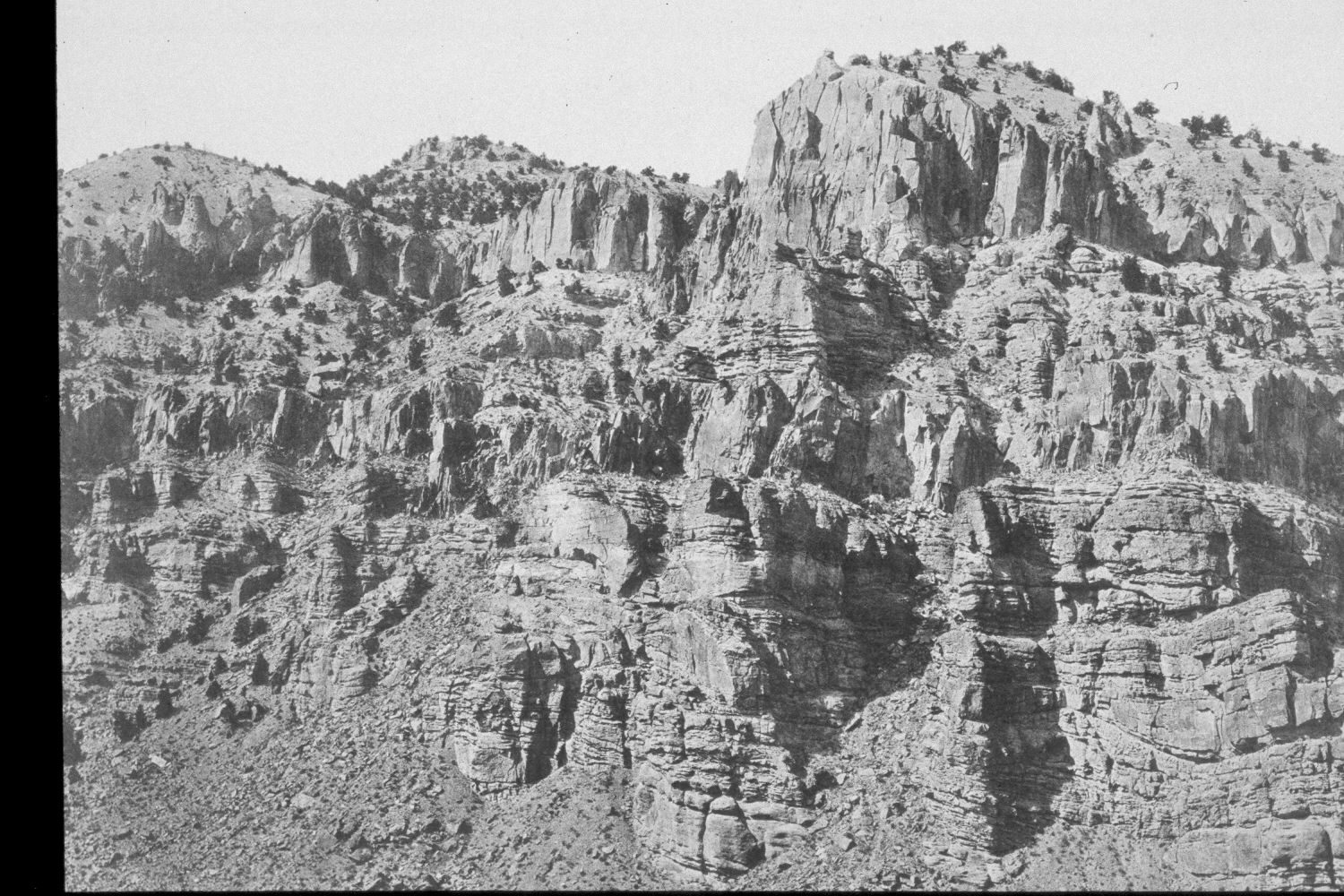
2003
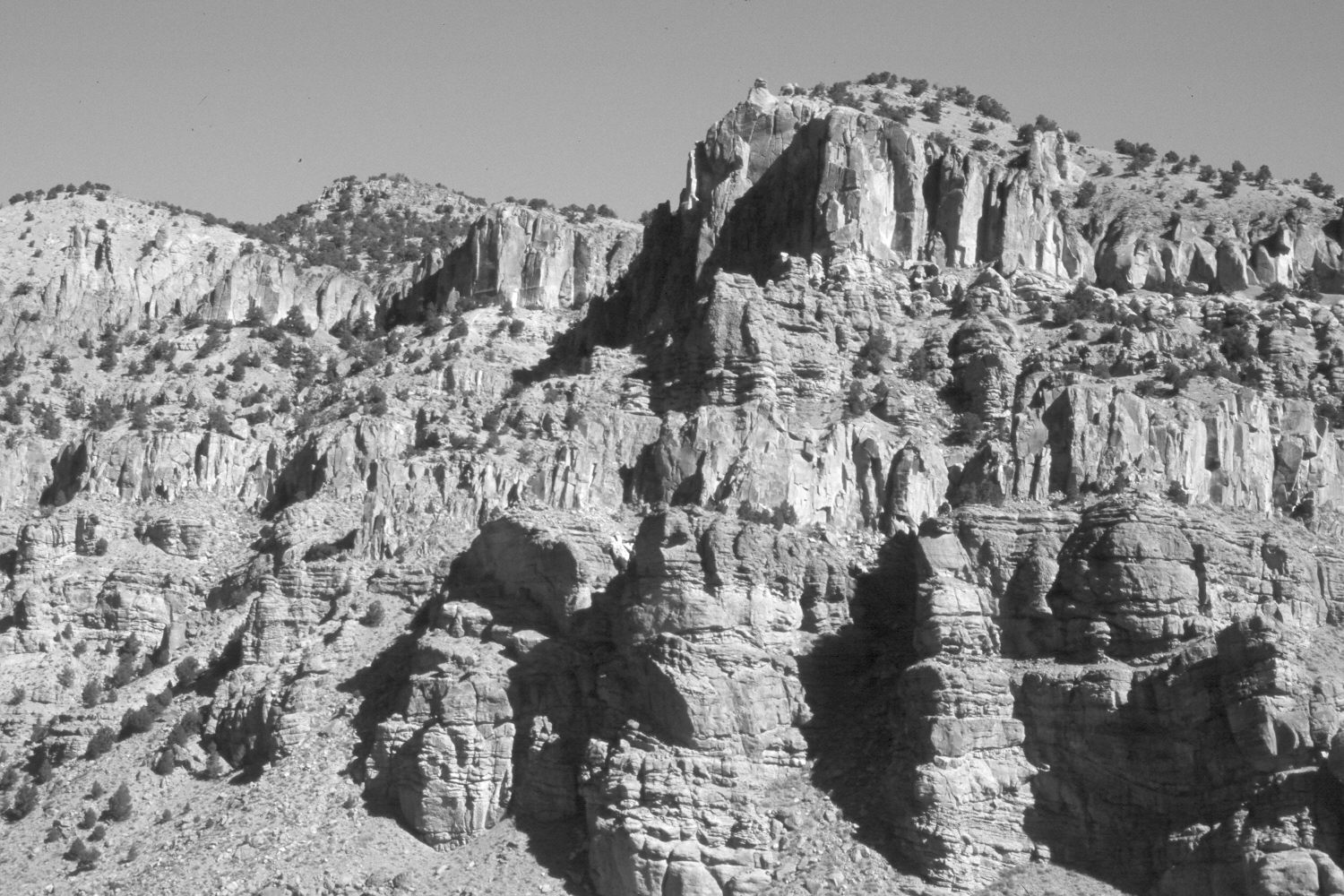
Description:
Plate 396X. Kingston Canyon 1872- 2003 Viewed north-northwest near the upper end of Kingston Canyon. The East Fork of the Sevier River and Utah Highway 62 are just below the cliffs in this photo-pair. There has been very little change on these dry, south-facing cliffs. There are a few new pinyon and juniper, but there has been no major erosion on the cliff-face. The low-growing shrubs are mostly Wyoming big sage and rubber rabbitbrush. The area is not grazed by livestock. The camera station is on property newly acquired by the Utah Division of Wildlife Resources. Cottonwoods, box elder (Acer negundo), river birch, and willows line the East Fork below the cliffs.
Photo Information:
U.S. Geological Survey Photograph taken by John Hillers in 1872; retake by Charles E. Kay on October 1, 2003 - - Photo No. 5279-31A. The original photograph is not in the National Archives nor in the USGS Photographic Library, but instead is Heliotype V in C.E. Dutton’s 1880 Report on the geology of the high plateaus of Utah, Government Printing Office, Washington D.C. 307 pp.
Vegetative Community:
Pinyon, Juniper, Sagebrush, Riparian
Location:
South West: Section 22, Range 2½ West, Township 30 South; UTM 403200 E, 4227200 N; elevation 6,440 ft.