Kanab Creek
1939
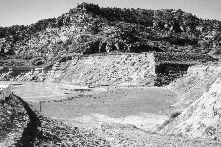
2005
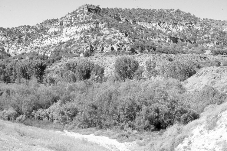
Description:
Plate 863X. Kanab Creek 1939 – 2005 Viewed southwest down Kanab Creek. U.S. Highway 89 is on the left, while Tiny Canyon is on the right. Willows and cottonwoods have increased, as have tamarisk and Russian olive. The active stream channel has narrowed and is more stable today than in earlier times. Pinyon and juniper have increased in the distance, while oakbrush has increased at the base of the cliffs. Sagebrush, rubber rabbitbrush, and skunkbrush are common on drier sites. Original photograph taken by H.E. Gregory (No. 950) in 1939; retake by Charles E. Kay on June 19, 2005 - - Photo No. 5455-2.
Photo Information:
Original photograph held in the U.S. Geological Survey Photographic Library, Denver, CO. See Webb et al. (1991:17) for a 1984 retake - - the USGS retake is incorrectly labeled as being at the mouth of Three Lakes Canyon.
Vegetative Community:
Riparian, Pinyon, Juniper, Sagebrush, Oakbrush
Location:
South West: Section 5, Range 6 West, Township 43 South; UTM 362450 E, 4106950 N; elevation 5,100 ft.