Johnson Canyon
1872
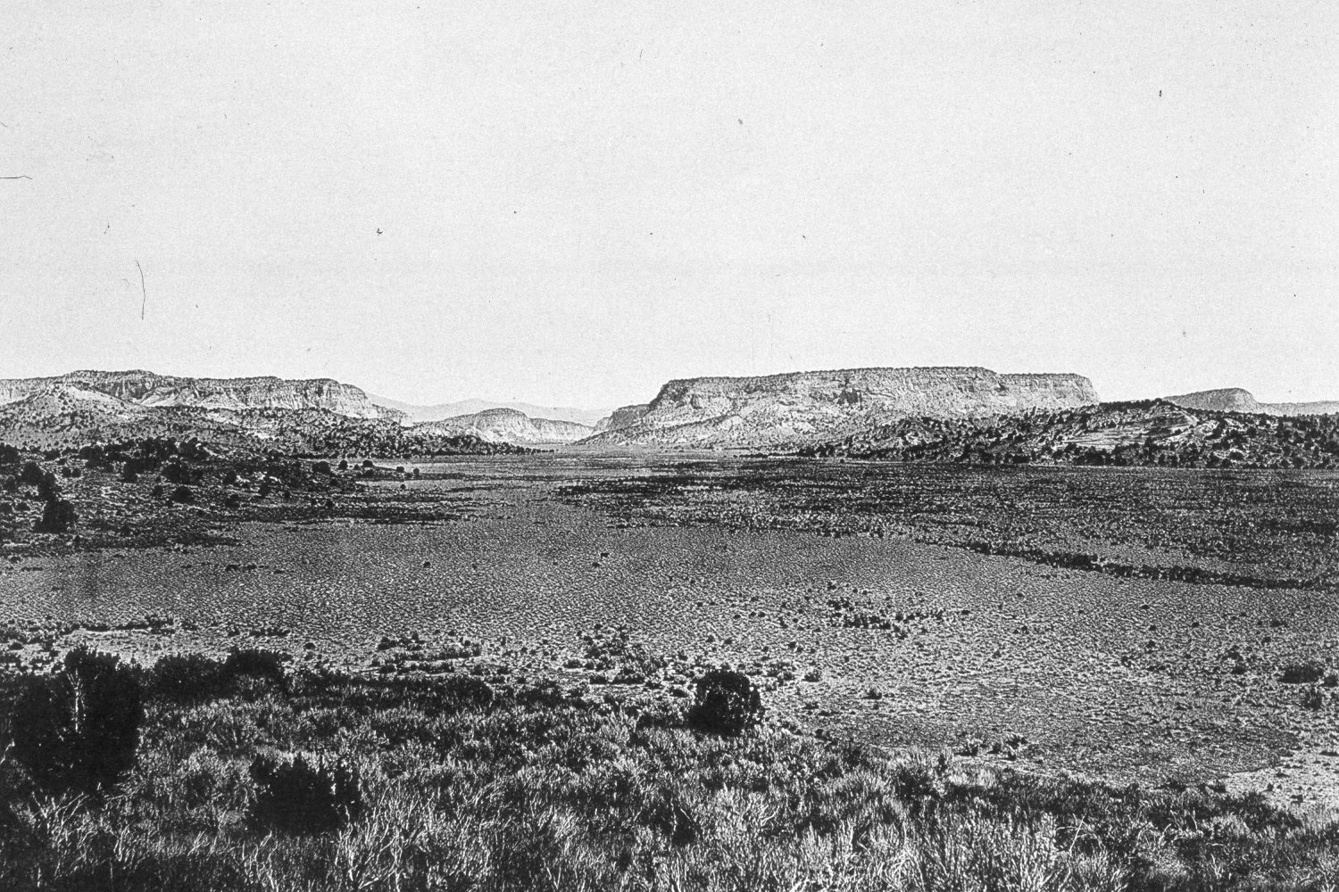
2004
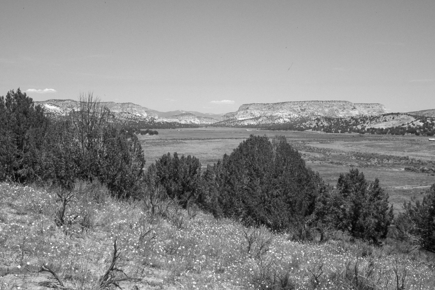
Description:
Plate 471X. Johnson Canyon 1872 – 2004 Viewed north-northeast up Johnson Canyon. Pinyon and juniper now block the original camera station, so the retake was made from the nearest open area, which is at a slightly higher elevation. In addition, a house has recently been constructed just over the hill on the left. The valley bottom is private and most areas have been cultivated at various points in the past. In 1872, there was no gully down Johnson Wash, while today Johnson Creek is at the bottom of a 20 to 30 foot deep arroyo. There is also a 30 foot deep arroyo at the base of the hill below the camera station that was absent when the original image was made. Pinyon and juniper have increased markedly. Wyoming big sage in the foreground has been killed by the recent drought and competition from the encroaching juniper. Indian rice grass is the most prominent native grass, however, cheatgrass is abundant. Original photograph taken by John Hillers in 1872; retake by Charles E. Kay on June 6, 2004 - - Photo No. 5330-7A.
Photo Information:
The original photograph appears as Plate 28 in Dutton (1882). The 1872 image is also held in the U.S. Geological Survey Photograph Library, Denver, CO where it is catalogued as H.E. Gregory No. 1272. For earlier retakes see Graf (1988:219), which shows the arroyo at the base of the hill, and Webb et al (1991:5).
Vegetative Community:
Pinyon, Juniper, Sagebrush
Location:
South West: Section 15, Range 5 West, Township 42 South; UTM 376250 E, 4113700 N; elevation 5,570 ft.