Hurricane Cliffs
1909
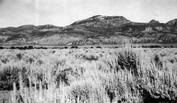
2006
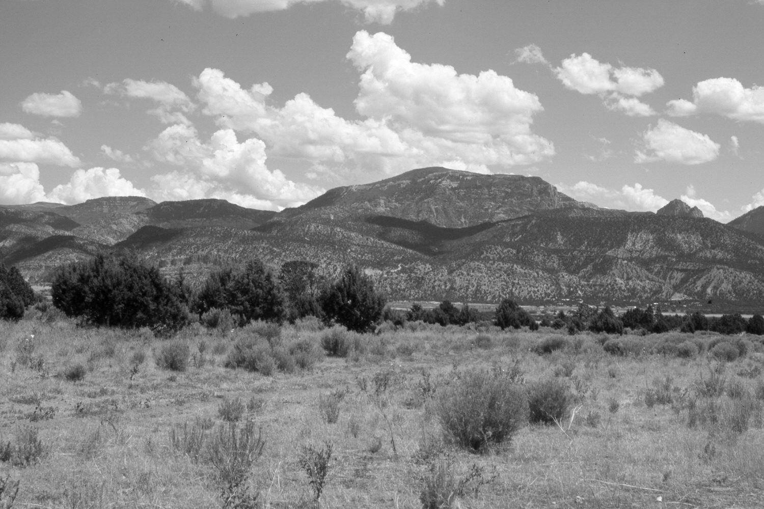
Description:
Plate 1412X. Hurricane Cliffs 1909 – 2006 Viewed east-northeast to the Hurricane Cliffs from east of New Harmony, Utah. Horse Ranch Mountain (8,726 ft) is on the skyline. Pinyon and juniper now block the original photopoint, so the retake was made from the nearest open area, which is a cleared agricultural field. Pinyon, juniper, and oakbrush have all increased. New buildings have been constructed. Plates 1412x and 1413x form a panorama.
Photo Information:
Original photograph taken by G.B. Richardson (No. 170a) in 1909; retake by Charles E. Kay on August 7, 2006 - - Photo No. 5725-1. Original photograph held by the U.S. Geological Survey Photographic Library, Denver, CO.
Vegetative Community:
Pinyon, Juniper
Location:
South West: Section 13, Range 13 West, Township 38 South; UTM 300800 E, 4151250 N; elevation 5,300 ft.