Holt Canyon
1928
2007
Description:
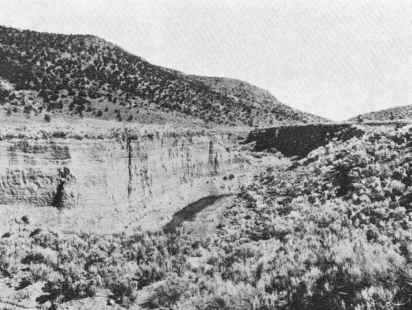
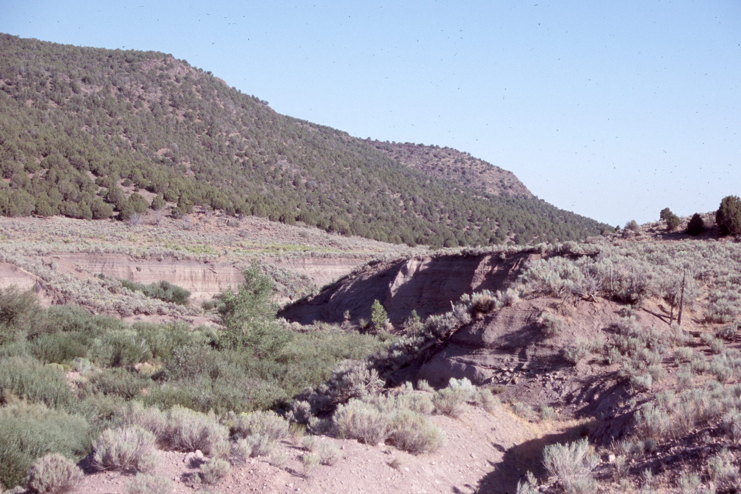
Plate 1497X. Holt Canyon 1928 – 2007 Viewed north down Mountain Meadow Wash in Holt Canyon - - see Plates 1489x to 1491x. The original camera station has been destroyed by operation of a gravel pit on private property, so the retake was made from above the eastern pit wall. This is where the Old Spanish Trail entered Mountain Meadows on the way to California. In the early 1800’s, this valley was a series of wet meadows and dry grasslands. Sagebrush was absent and pinyon-juniper was confined to the highest peaks (Cottam 1929, Cottam and Stewart 1940). The area was settled by Europeans during the 1860’s after which cattle and sheep were permitted to overgraze the range. Prior to that time there were no arroyos in the valley. Floods during 1884 overwhelmed the devastated rangelands and cut most of the gullies seen in the valley today. As livestock destroyed the original grass cover, sagebrush and pinyon-juniper increased (Cottam and Stewart 1940). All this took place before the 1928 photograph was made. Today the main arroyo has started to heal, as willows and cottonwoods have increased. Pinyon and juniper have continued their increase.
Photo Information:
Original photograph taken by Walter P. Cottam ca. 1928; retake by Charles E. Kay on August 23, 2007 - - Photo No. 5832-24. Original photograph from Cottam (1929:Plate 9).
Vegetative Community:
Pinyon, Juniper, Sagebrush
Location:
South West: Section 26, Range16 West, Township 37 South; UTM 269298 E, 4158628 N; elevation 5,752 ft.