High Mountain
1909
2006
Description:
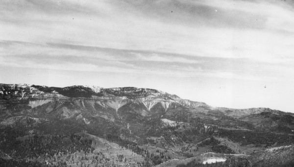
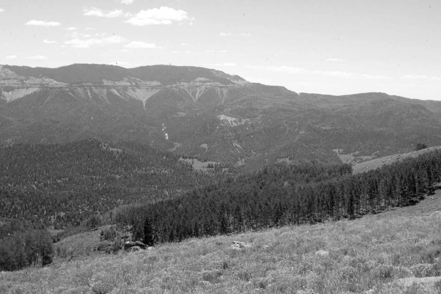
Plate 1400X. High Mountain 1909 – 2006 Viewed southeast across Ashdown Creek from High Mountain. Cedar Breaks National Monument is on the left, while Blowhard Mountain (10,596 ft) is in the center. Note the FAA radar dome on the top of Blowhard in the retake. Conifers have increased, while aspen has declined. Most aspen stands have not regenerated in many years due to excessive ungulate herbivory (Kay and Bartos 2000). Plates 1397x to 1400x form a panorama from left to right.
Photo Information:
Original photograph taken by G.B. Richardson (No. 205d) in 1909; retake by Charles E. Kay on August 6, 2006 - - Photo No. 5720-23. Original photograph held by the U.S. Geological Survey Photographic Library, Denver, CO.
Vegetative Community:
Conifer, Aspen
Location:
South West: Section 18, Range 9 West, Township 36 South; UTM 331300 E, 4170500 N; elevation 9,900 ft.