Henrieville
1907
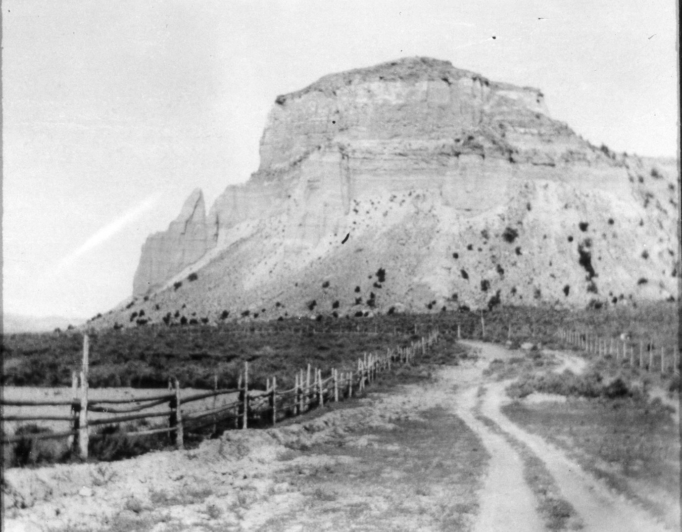
2004
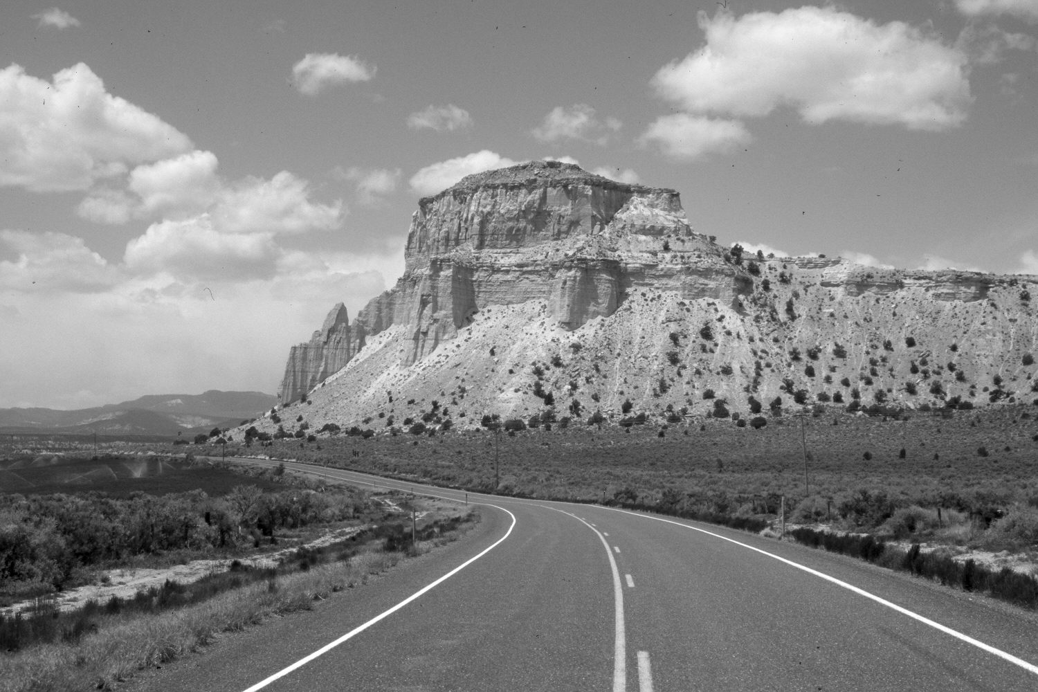
Description:
Plate 417X. Henrieville 1907 – 2004 Viewed west from the western edge of Henrieville, UT. Utah Highway 12 has been realigned, widened, and paved. There has been a slight increase in pinyon and juniper on the distant butte, while an irrigated field has been added south of the highway. Otherwise, very little has changed. The initial image is slightly out-of-focus.
Photo Information:
The original photograph was taken by an unknown photographer in 1907; retake by Charles E. Kay on May 11, 2004 - - Photo No. 5292-29. Original photograph (No. 10718) held by the Utah Historical Society, Salt Lake City, UT.
Vegetative Community:
Pinyon, Juniper
Location:
South West: Section 28, Range 23 West, Township 37 South; UTM 410950 E, 4157600 N; elevation 5,960 ft.
January 2018