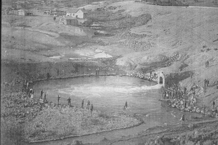
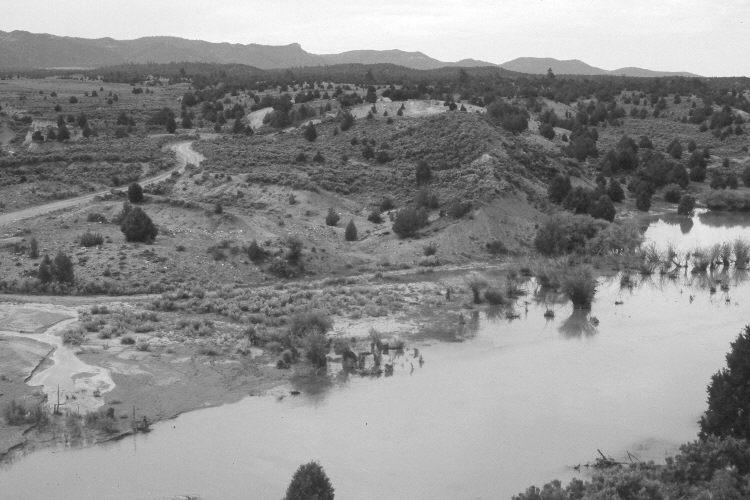
Hatch Dam
1910
2005
Description:
Plate 898X. Hatch Dam 1910 – 2005 Viewed southeast to the dam on the Sevier River south of Hatch, Utah. The dam failed in 1914 and was not rebuilt - - see Plate 485x. The Sevier River was at flood stage, and had been for a month or more, when the retake was made. Willows have increased along the river, as has Russian olive. Pinyon and juniper have increased, especially in the distance. Sagebrush has increased on the face of the old dam, as well as on other disturbed sites. The buildings are all gone, while the gully to the left has downcut 20 feet or more. Ponderosa pine are more abundant in the distance.
Photo Information:
Original photograph taken ca. 1910; retake by Charles E. Kay on June 23, 2005 - - Photo No. 5465-13A. Original photograph held by the Kanab Museum, Kanab, UT.
Vegetative Community:
Riparian, Pinyon, Juniper, Sagebrush, Conifer
Location:
South West: Section 32, Range 5 West, Township 36 South; UTM 372850 E, 4165750 N; elevation 6,980 ft.