Harris Flat
1936
2005
Description:
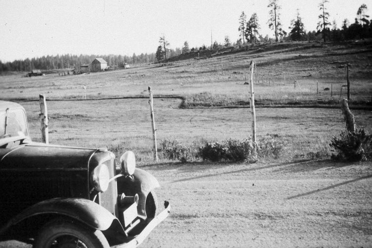
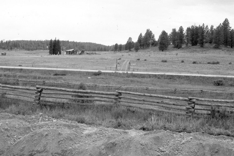
Plate 984X. Harris Flat 1936 – 2005 Viewed east-southeast over the old snow survey course at Harris Flat. In 1936, a series of snow courses were established throughout southern Utah by what is today the Natural Resources Conservation Service (NRCS). When they were first set-up, photographs were taken at each snow survey site. Although the snow course at Harris Flat is no longer used by NRCS, the old photos remain. Utah Highway 14 has been realigned, widened, and paved. Ponderosa pine has increased despite selective logging. Most of the old buildings are gone.
Photo Information:
Original photograph (NRCS – 202) taken on September 8, 1936; retake by Charles E. Kay on July 31, 2005 - - Photo No. 5497-2. Original photograph held by the Snow Survey Supervisor, Natural Resources Conservation Service, Salt Lake City, UT.
Vegetative Community:
Conifer, Dry Meadow
Location:
South West: Section 19, Range 6 West, Township 38 South; UTM 360800 E, 4150650 N; elevation 7,800 ft.