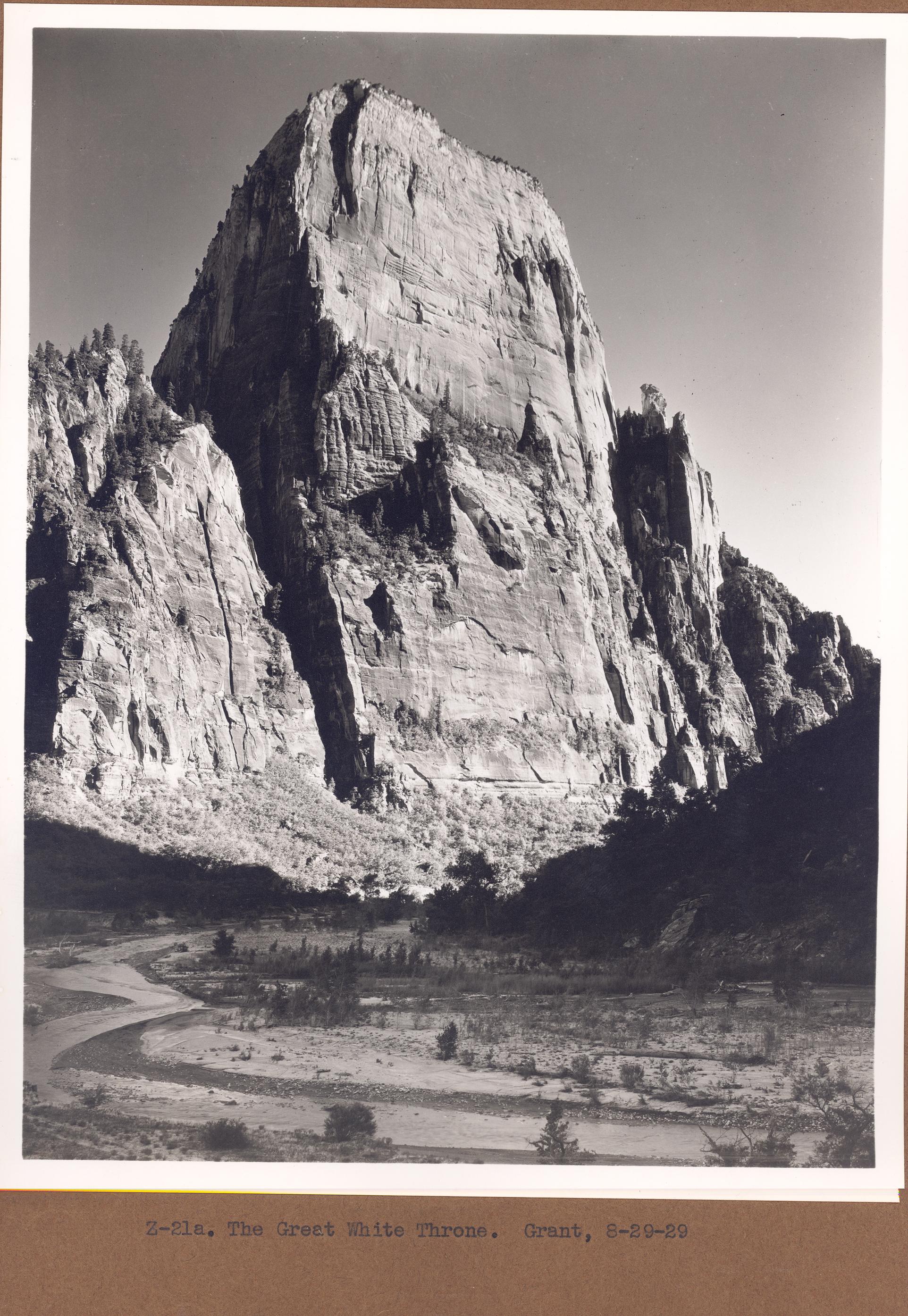
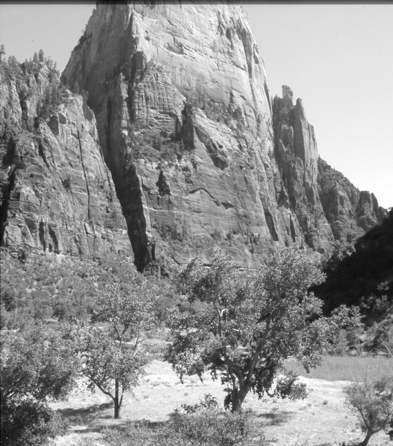
Great White Throne
1929
2006
Description:
Plate 1191X. Great White Throne 1929 – 2006 Viewed southeast across the Virgin River to the Great White Throne (6,744 ft) in Zion National Park. Woody vegetation now blocks the original camera station, so the retake was made from the nearest open area. The Virgin River has stabilized and downcut since 1929 because the Park Service has channelized sections of the river to protect the park road and Zion Canyon Lodge (Hereford et al 1996, Grand Canyon Trust 2001). Note the abundant regenerating cottonwoods along the Virgin River in 1929 and the absence of new willows and cottonwoods today. This is because mule deer are not hunted in the park and that abnormal concentration of deer has repeatedly browsed newly established seedlings, preventing woody riparian species from regenerating (Steen 1999, Ripple and Beschta 2006). Thus unlike sites throughout southern Utah, including areas immediately outside the park, where riparian conditions have improved since the early 1900’s, woody riparian vegetation has declined in Zion Canyon. Contrary to what one might eXpect, riparian conditions are worse inside the park, where livestock grazing has been prohibited for over 80 years, than outside the park where yearly cattle grazing occurs. This is similar to other national parks where unhunted ungulate populations have destroyed riparian communities (Kay and Walker 1997, National Park Service 2006). This did not occur in the past because native hunters once kept deer and elk populations at very low levels (Kay 1994, 1998). As the old cottonwoods in Zion Canyon die, they are not being replaced with new trees eXcept where mule deer have been eXcluded.
Photo Information:
Original photograph taken by Grant (Z-21a) on August 29, 1929; retake by Charles E. Kay on June 5, 2006 - - Photo No. 5633-11. Original photograph (Zion 12366) held by the National Park Service, Zion National Park, Springdale, UT.
Vegetative Community:
Riparian
Location:
South West: Section 36, Range 10 West, Township 40½ South; UTM 327900 E, 4126800 N; elevation 4,350 ft.