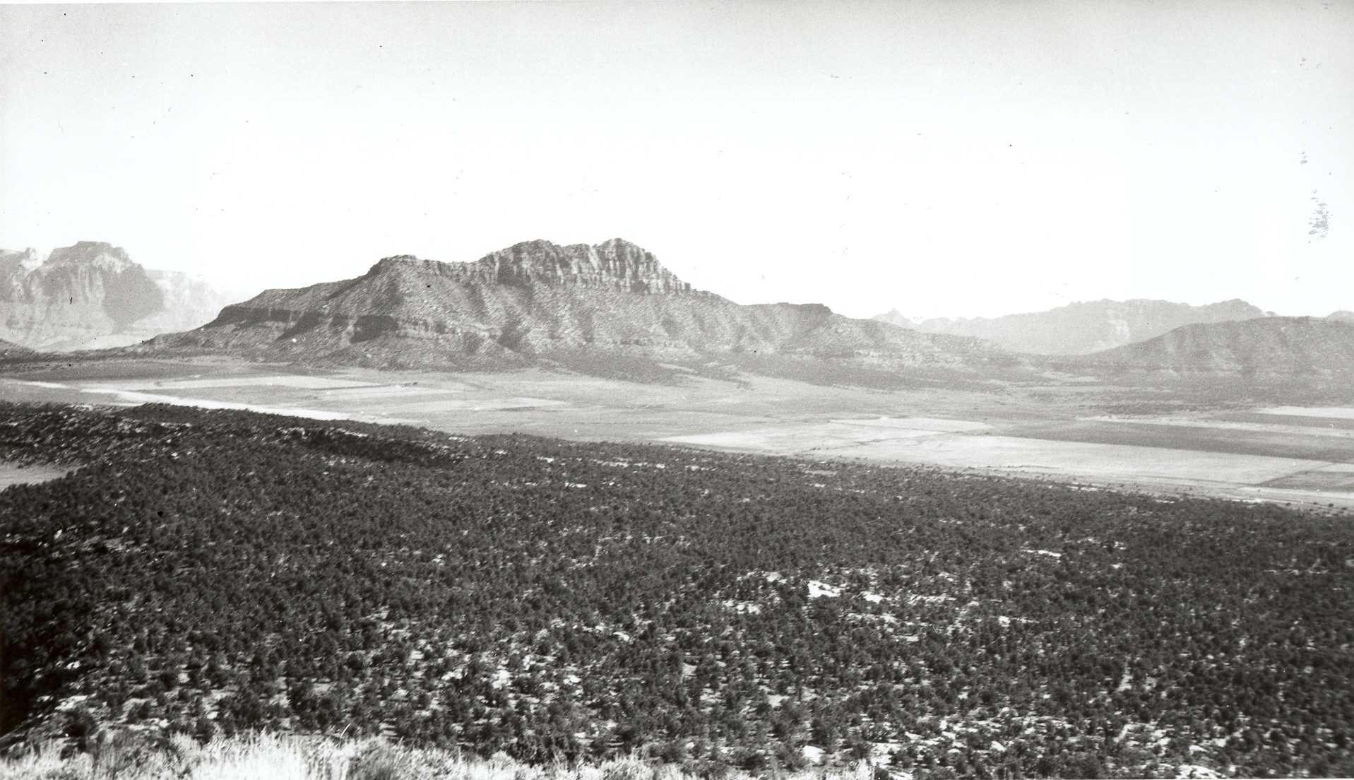
Gray Knoll
1937
2006
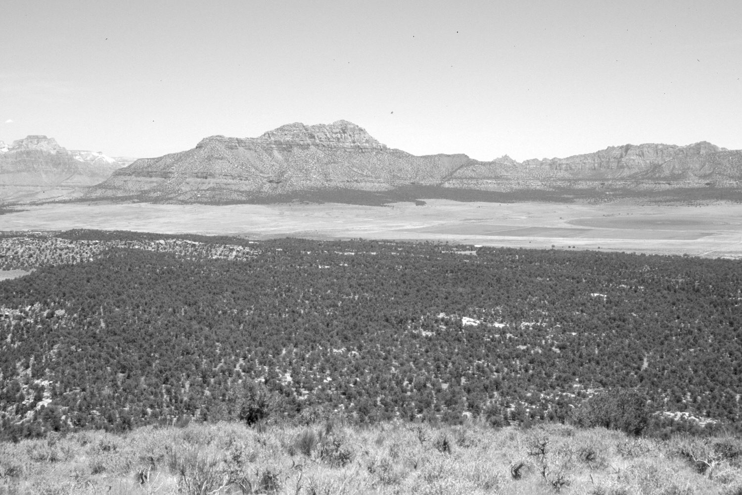
Description:
Plate 1188X. Gray Knoll 1937 – 2006 Viewed east-northeast from Gray Knoll to Big Plain. Smithsonian Butte (6,632 ft) is in the distance. Pinyon and juniper have increased, though some areas have been cleared. Big Plain is privately owned. Plates 1188X and 1187X form a panorama.
Photo Information:
Original photograph taken by H.E. Gregory (No. 802) in 1937; retake by Charles E. Kay on June 4, 2006 - - Photo No. 5630-25A. Original photograph held by the U.S. Geological Survey Photographic Library, Denver, CO.
Vegetative Community:
Pinyon, Juniper
Location:
South West: Section 6, Range 11 West, Township 43 South; UTM 309500 E, 4105400 N; elevation 5,511 ft.
January 2018