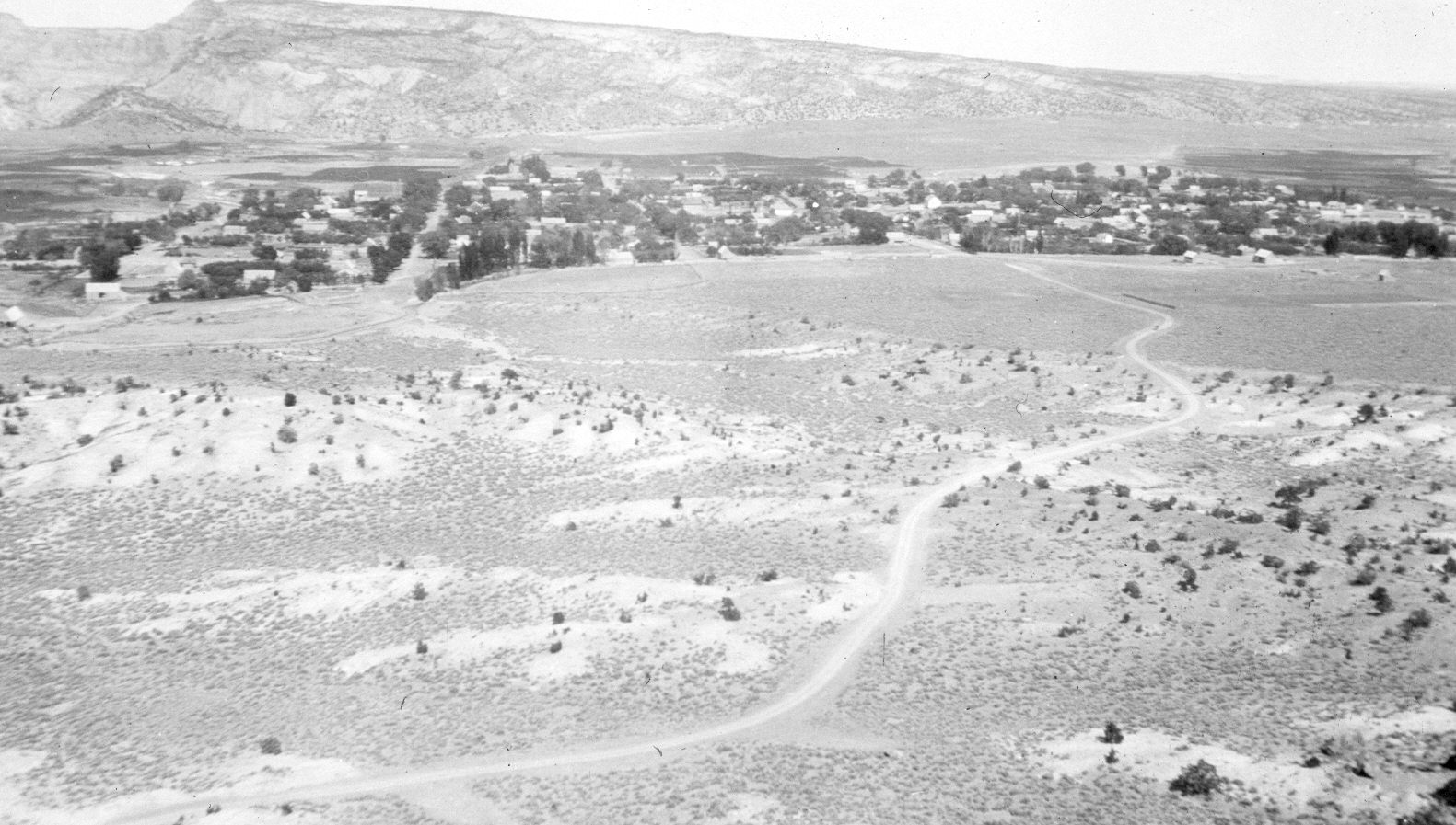
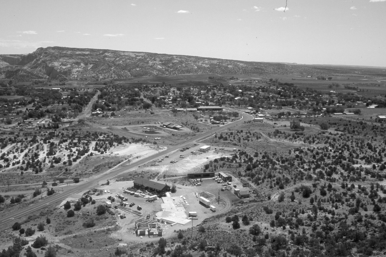
Escalante, Utah
1918
2004
Description:
Plate 509X. Escalante, Utah 1918 – 2004 Viewed east-southeast to Escalante townsite. The Escalante River is on the left, as is the upper end of Escalante Canyon. Pinyon and juniper have increased, especially in the foreground. Utah Highway 12 has been realigned, widened, and paved. The new construction at the base of the camera station is a joint BLM, USFS, and National Park Service visitor center.
Photo Information:
Original photograph taken by H.E. Gregory (No. 370) in 1918; retake by Charles E. Kay on June 11, 2004 - - Photo No. 5344-23. Original photograph held in the U.S. Geological Survey Photographic Library, Denver, CO.
Vegetative Community:
Pinyon, Juniper
Location:
South West: Section 7, Range 3 East, Township 35 South; UTM 445600 E, 4180700 N; elevation 6,260 ft.
January 2018