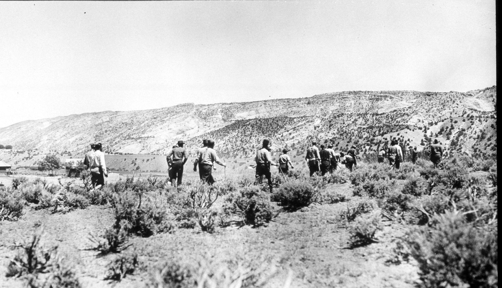
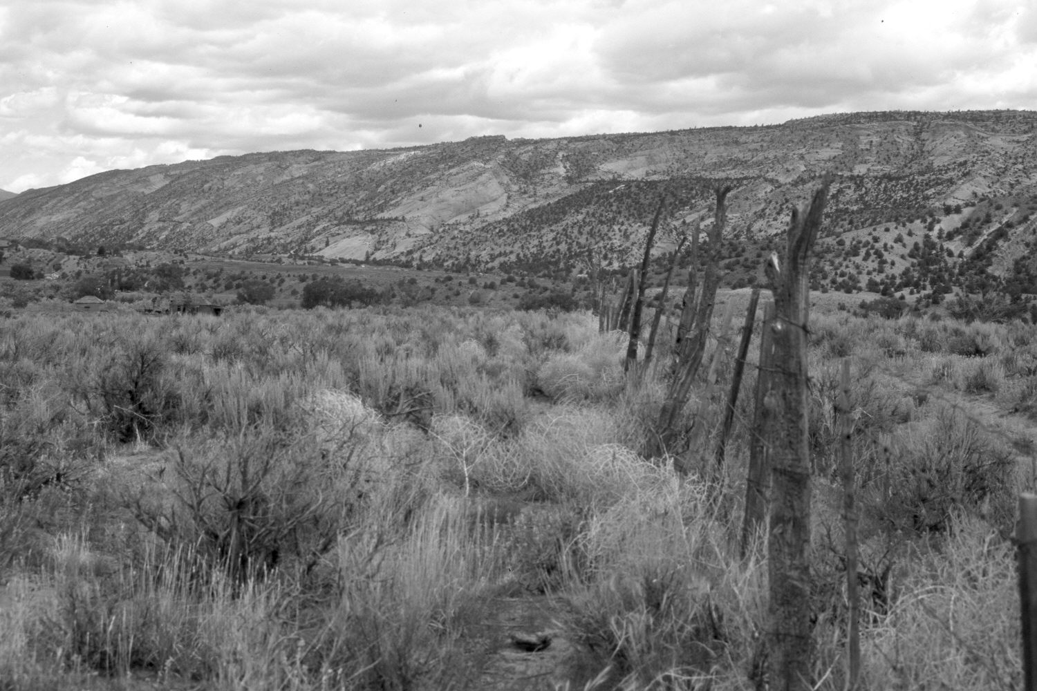
Escalante River
1933
2004
Description:
Plate 501X. Escalante River 1933 – 2004 Viewed north to the Escalante River east of Escalante, UT. The Escalante River flows from left to right, while Pine Creek is located at the base of the distant uplift. Cottonwoods have increased along the river, while Wyoming big sage has increased in the foreground - - some sage, however, has been killed by the recent drought. A fence and access road have been added. Pinyon and juniper appear to have increased in the distance. The two buildings visible in the 1933 image are still standing, though no longer in use. Blue grama grass and globe mallow are the most common understory species in the foreground. Blowing tumble weeds have been trapped on the left side of the fence.
Photo Information:
U.S. Forest Service photograph taken by an unknown photographer ca. 1933; retake by Charles E. Kay on June 10, 2004 - - Photo No. 5341-20. Original photograph held by Southern Utah University Archives and Special Collections, Cedar City, UT.
Vegetative Community:
Riparian, Sagebrush, Pinyon, Juniper
Location:
South West: Section 16, Range 3 East, Township 35 South; UTM 448750 E, 4180100 N; elevation 5,790 ft.