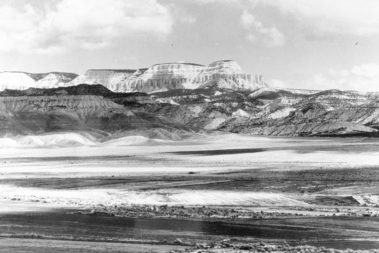
East Valley
1944
2004
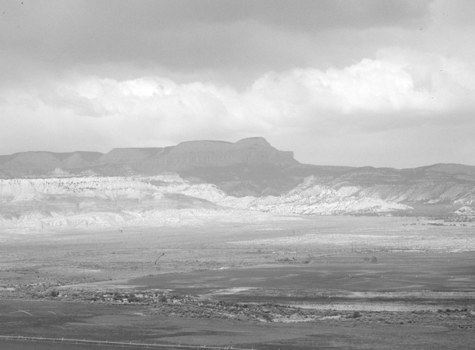
Description:
Plate 496X. East Valley 1944 – 2004 Viewed northeast across East Valley to Powell Point (10,188 ft.). Private, irrigated fields line North Creek. There has been little apparent change.
Photo Information:
Original photograph taken by H.E. Gregory (No. 1299) in 1944; retake by Charles E. Kay on June 9, 2004 - - Photo No. 5339-20. Original photograph held in the U.S. Geological Survey Photographic Library, Denver, CO.
Vegetative Community:
Pinyon, Juniper, Sagebrush
Location:
South West: Section 31, Range 2 West, Township 36 South; UTM 407150 E, 4165000 N; elevation 6,360 ft.
January 2018