East Fork Of The Sevier River
1959
2003
Description:
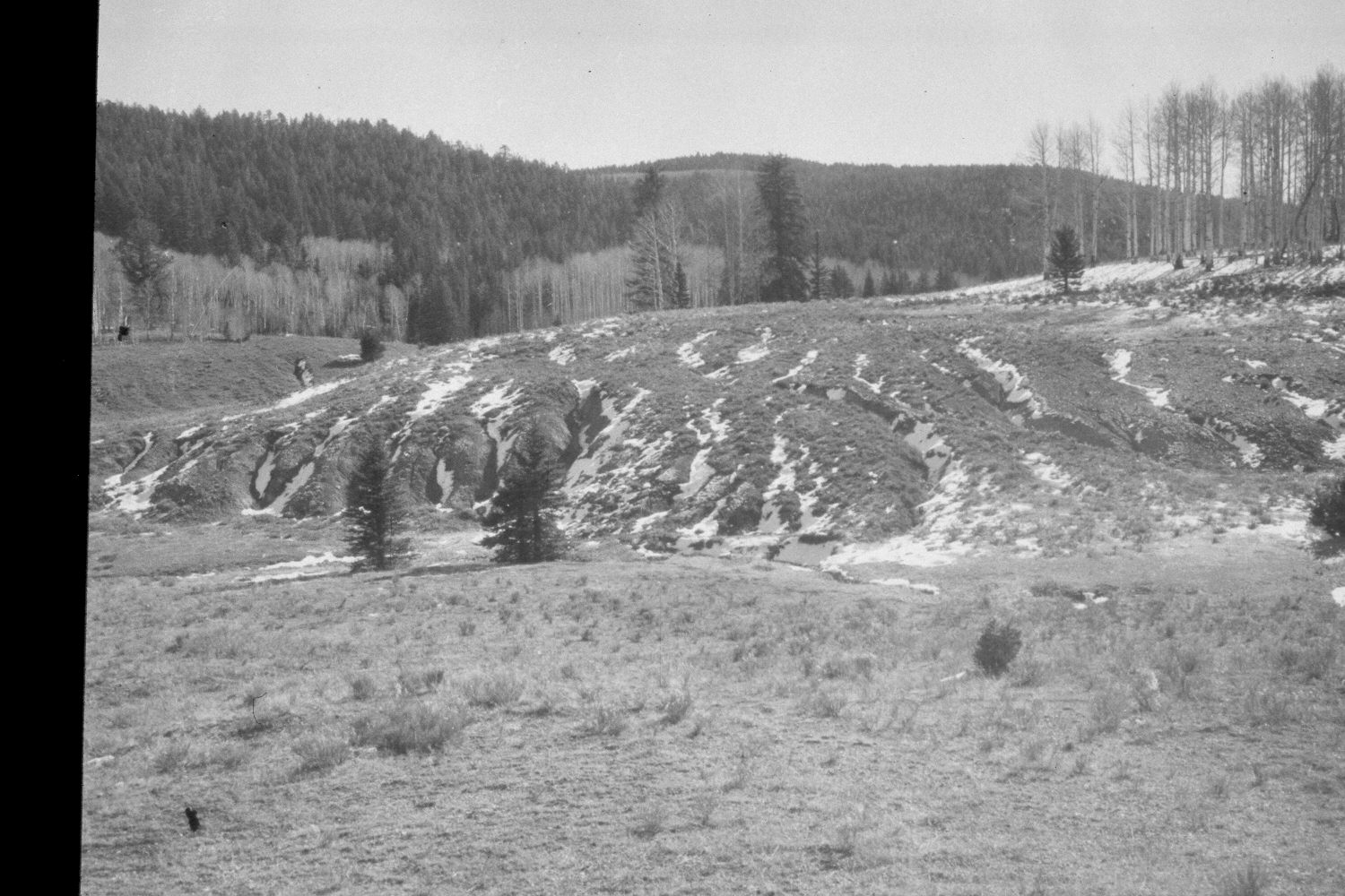
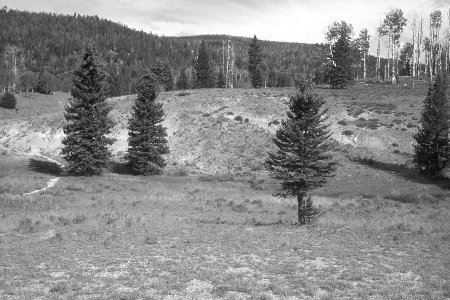
Plate 294X. East Fork of the Sevier River 1959 - 2003 Viewed southeast across the East Fork of the Sevier River just above its confluence with Mill Creek on the Paunsaugunt Plateau. Conifers, primarily spruce, have increased, while aspen has declined. There are a few willows along the East Fork, but all are heavily browsed. Nonetheless, the streambanks appear more heavily vegetated today than they did in 1959. Part of the aspen stand on the ridge above the East Fork was burned by a recent wildfire (see Plate 293x), but the clone has not successfully regenerated due to excessive browsing by wildlife and livestock. The low shrubs are mostly rubber rabbitbrush. This area has not been treated or reseeded. The area was actively being grazed by cattle in 2003. Additional retakes were made by the Forest Service in 1988 and 2000.
Photo Information:
U.S. Forest Service photograph (unnumbered) taken in 1959; retake by Charles E. Kay on August 7, 2003 - - Photo No. 5229-18. Original photograph held in the range files on the Panguitch Ranger District, Dixie National Forest, Panguitch, UT.
Vegetative Community:
Conifer, Aspen, Riparian
Location:
South West: Section 10, Range 4½ West, Township 38 South; UTM 381100E, 4143800 N; elevation 8,320 ft.