East Fork Of The Sevier River
1966

2003
Description:
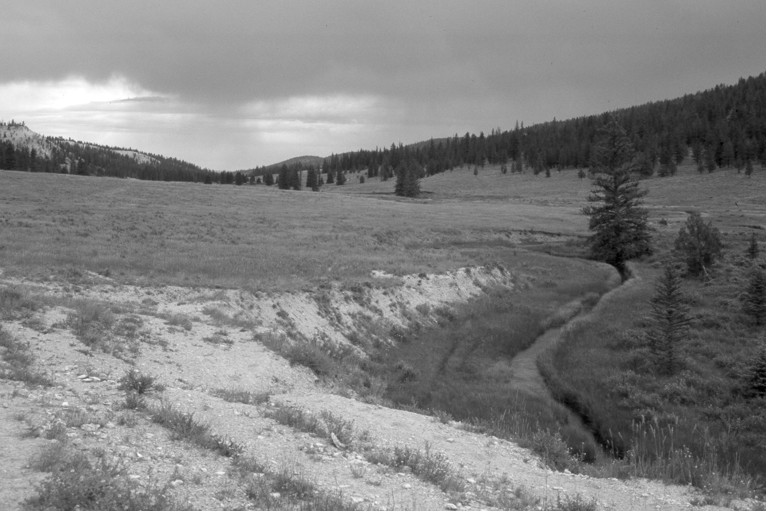
Plate 284X. East Fork of the Sevier River 1966 - 2003 Viewed northeast down the East Fork of the Sevier River on the Paunsaugunt Plateau. The original photograph was taken shortly after the area to the left of the stream had been contour-trenched and reseeded by the Forest Service to control erosion and improve range conditions. The East Fork has narrowed and deepened, as would be expected if range conditions had improved. The streambanks are also more heavily vegetated today than they were in the past. The shrubs in the floodplain are mostly shrubby cinquefoil and a few, heavily-browsed willows, while native sedges and rushes are common closer to the stream. Mountain big sage has invaded the treated area, where smooth brome and intermediate wheatgrass are the most abundant species. Conifers, primarily ponderosa pine and spruce, have increased. The lower hillside to the right of the stream was also contour-trenched and reseeded. The area had not been grazed by livestock in 2003 when this camera station was revisited. The photopoint is located approximately one mile north of Blubber Creek.
Photo Information:
U.S. Forest Service photograph (unnumbered) taken on July 7, 1966; retake by Charles E. Kay on August 7, 2003 - - Photo No. 5225-13. Original photograph held by Southern Utah University Archives and Special Collections, Cedar City, UT.
Vegetative Community:
Riparian, Sagebrus, Dry Meadow, Conifer
Location:
South West: Section 25, Range 4½ West, Township 37 South; UTM 387600E, 4157450 N; elevation 7,920 ft.