East Fork Of The Sevier River
1960
2003
Description:
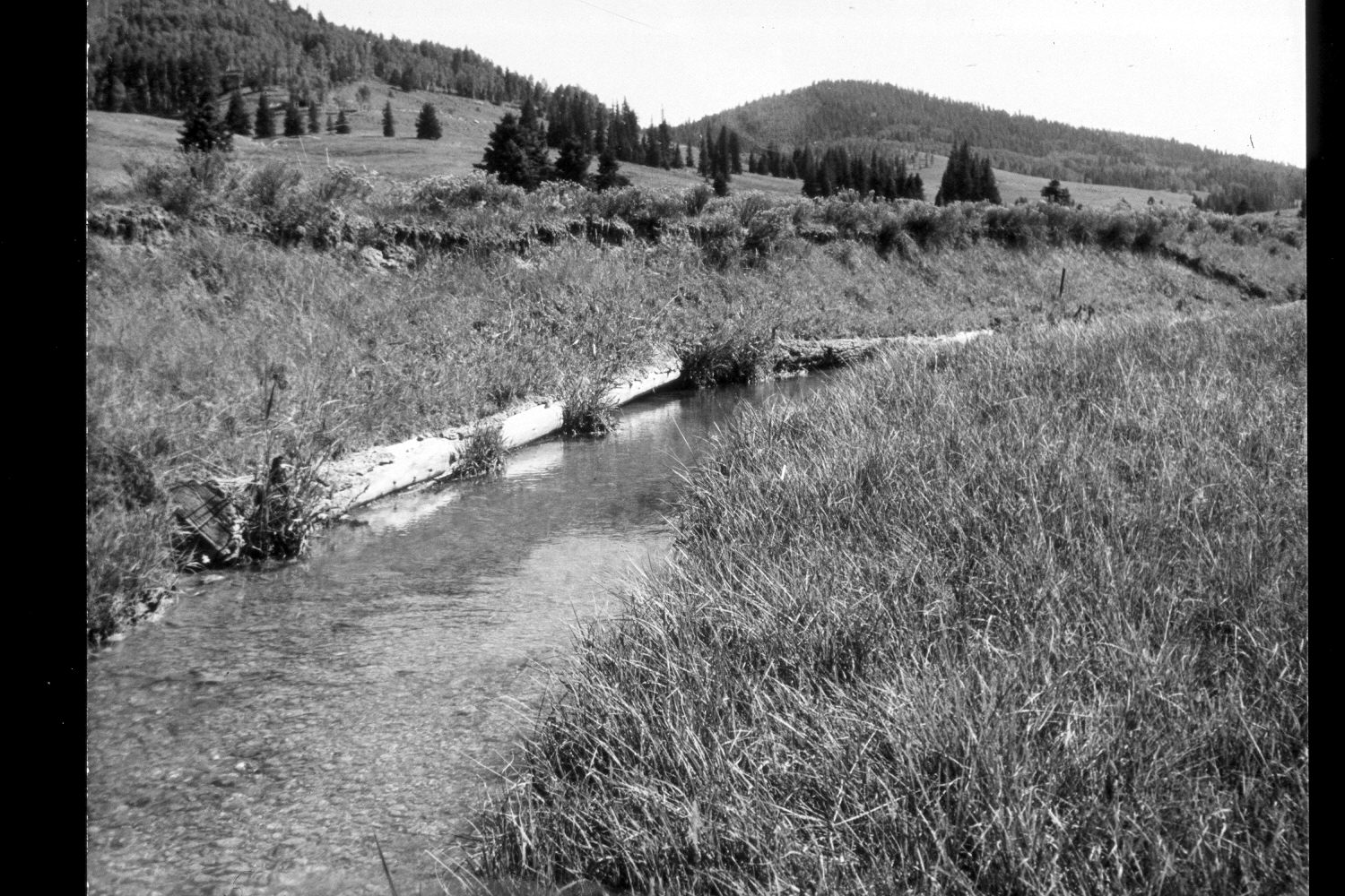
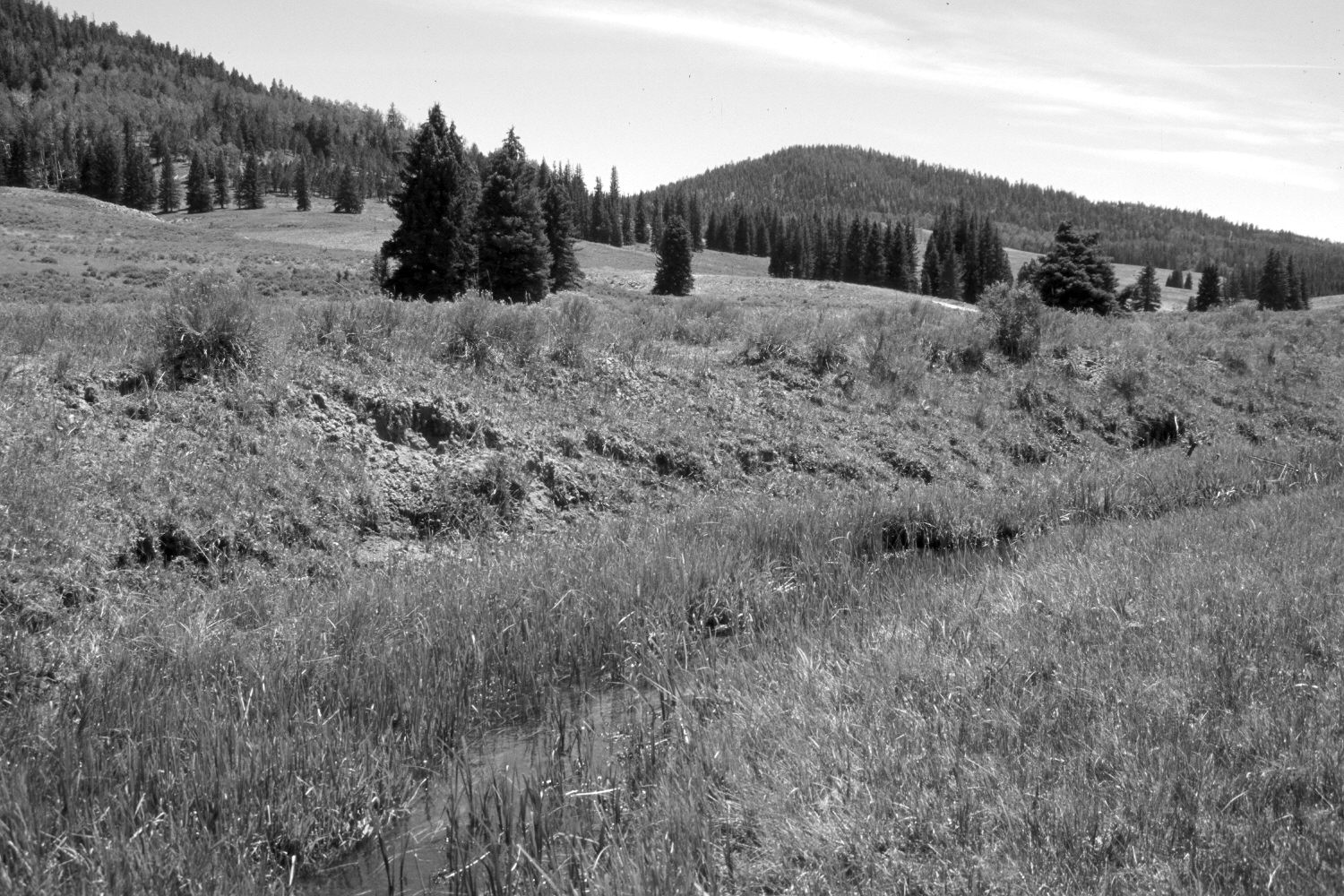
Plate 258X. East Fork of the Sevier River ca. 1960-2003 Viewed southeast up the East Fork of the Sevier River below its confluence with Oak Hollow. The log structures, originally built by the Forest Service to control streambank erosion, have decomposed. Most of the open areas have been contour-trenched and reseeded with smooth brome and Kentucky bluegrass to control erosion. The low-growing shrubs are mostly rubber rabbitbrush with a few heavily-browsed willows along the stream. Spruce, ponderosa pine, and juniper have all increased, while aspen has declined. The area had not been grazed by cattle in 2003 when the retake was made. This plate is similar to 257x except this photopoint is approximately 100 feet further south.
Photo Information:
U.S. Forest Service photograph (unnumbered) taken ca. 1960; retake by Charles E. Kay on August 5, 2003 - - Photo No. 5213-22A. Original photograph held by Southern Utah University Archives and Special Collections, Cedar City, UT.
Vegetative Community:
Dry Meadow, Conifer, Juniper, Aspen, Riparian
Location:
South West: Section 13, Range 4½ West, Township 38 South; UTM 385900E, 4151270 N; elevation 8,050 ft.