East Fork Of The Sevier River
1959
2003
Description:
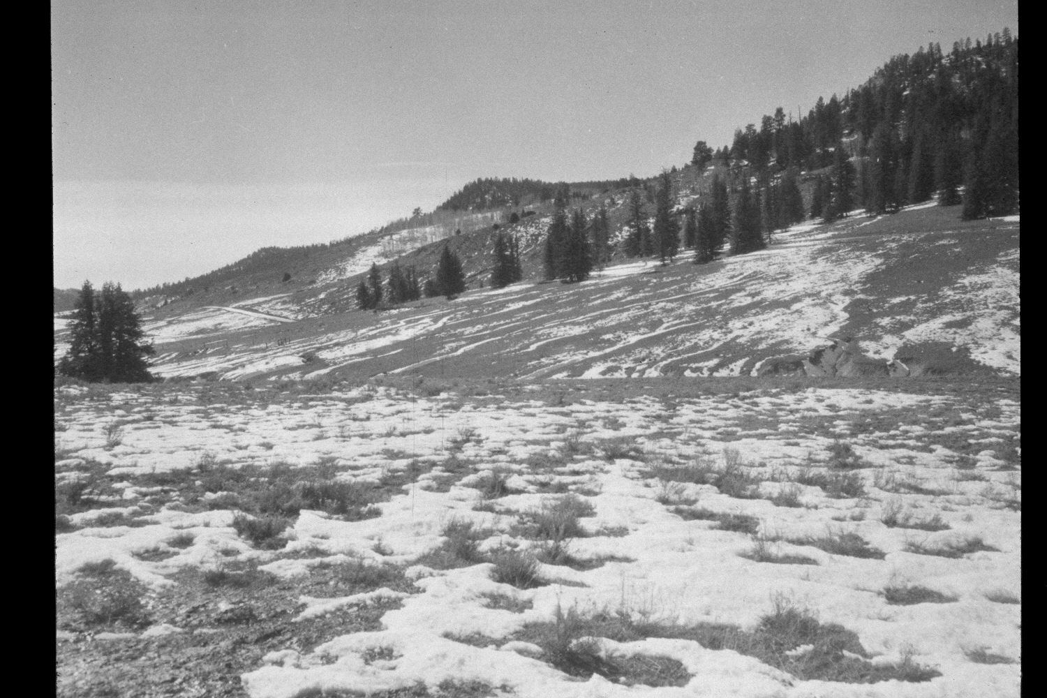
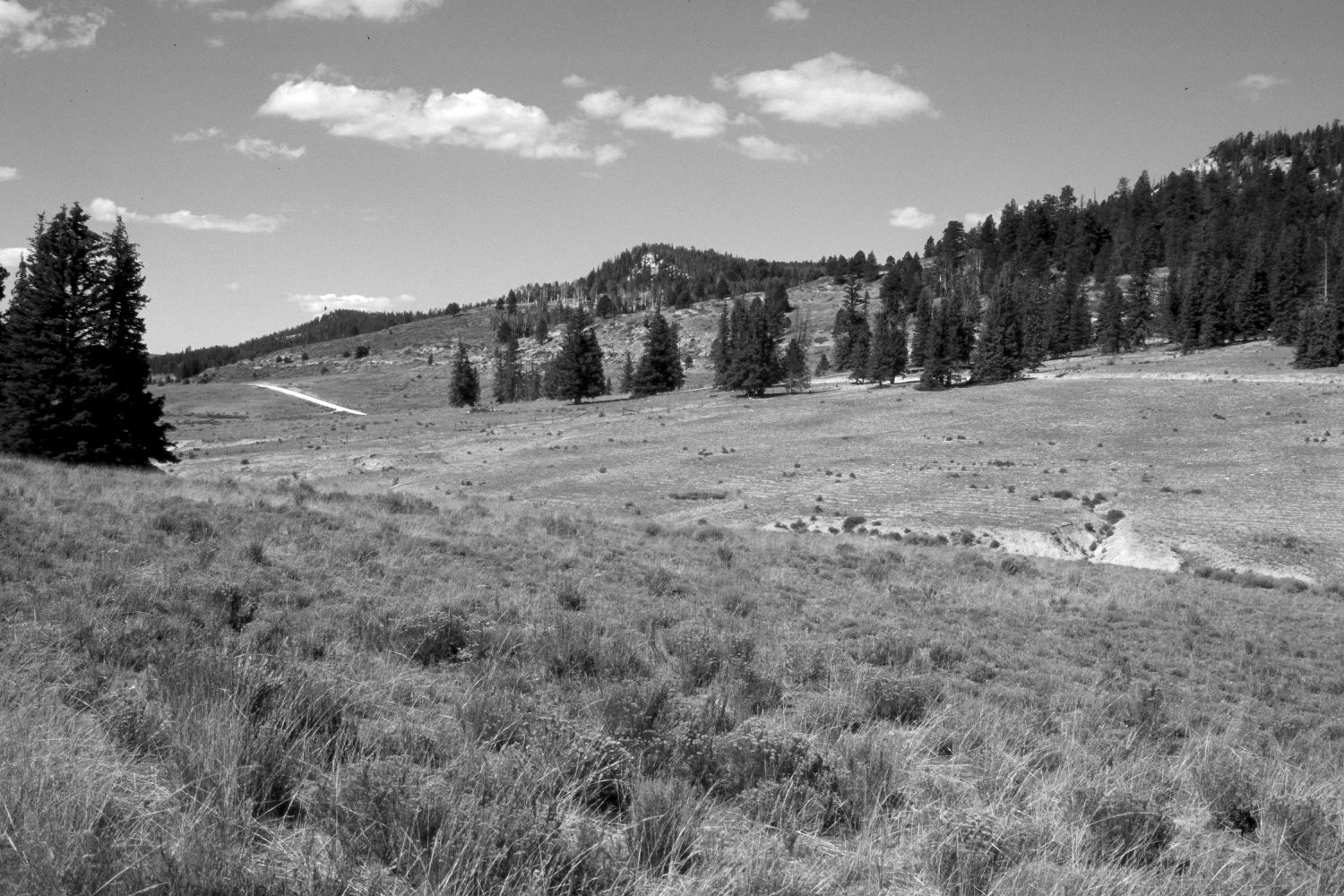
Plate 232X. East Fork of the Sevier River 1959 - 2003 Viewed southwest up the East Fork of the Sevier River just below its confluence with Podunk Creek. The East Fork is at the toe of the slope and is mostly hidden from view. Both the near and the far hillsides have been contour-trenched and reseeded to control erosion. Grasses are primarily smooth brome and intermediate wheatgrass. The shrubs in the foreground are mostly rubber rabbitbrush. In the distance, spruce has increased, while aspen has declined. The road in both photographs is USFS 087 - - the main East Fork road. A retake was made from this same camera station by the Forest Service in 1988.
Photo Information:
U.S. Forest Service photograph (unnumbered) taken in the spring of 1959; retake by Charles E. Kay on August 4, 2003 - - Photo No. 5206-15A. Original photograph held in the range files on the Panguitch Ranger District, Dixie National Forest, Panguitch, UT.
Vegetative Community:
Dry Meadow, Conifer, Aspen
Location:
South West: Section 13, Range 4 ½ West, Township 38 South; UTM 385950E, 4150900N; elevation 8,300 ft.