East Fork Of The Sevier River
1959
2003
Description:
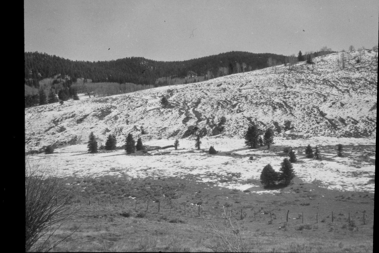
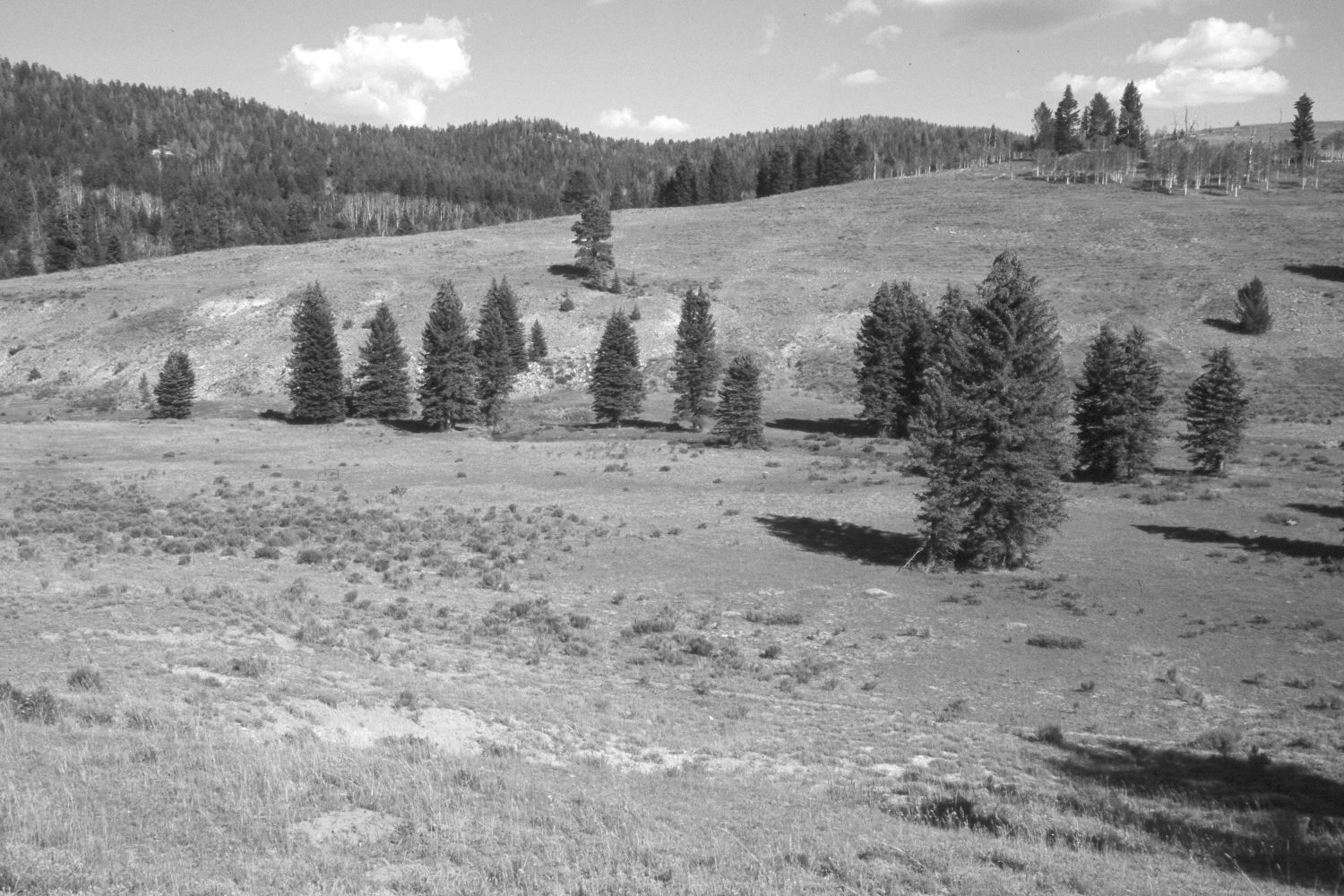
Plate 226X. East Fork of the Sevier River 1959 - 2003 Viewed east-southeast across the East Fork of the Sevier River just above the mouth of Crawford Creek. The shrubs in the foreground of the initial image were currants that were subsequently overgrown by spruce, which now block the original view. Thus, the retake was made from the nearest open area, which is a little further down the hill. Aspen on the near ridge successfully regenerated about 25 years ago when mule deer numbers were low (Kay and Bartos 2000). As deer and elk populations have increased, however, those new trees have been highlined and all aspen suckers repeatedly browsed. Aspen in the rest of the image has declined, while conifers, primarily spruce, have increased. The low shrubs are mostly rubber rabbitbrush and shrubby cinquefoil. The ridge across the stream has been contour-trenched and reseeded with non-native grasses to control erosion. The fence in the original image has been removed - - see Plate 229X. Retakes from the same camera station were also made by the Forest Service in 1988 and 2000.
Photo Information:
U.S. Forest Service photograph (unnumbered) taken in spring 1959; retake by Charles E. Kay on August 3, 2003 - - Photo No. 5203-12. Original photograph held in the range files on the Panguitch Ranger District, Dixie National Forest, Panguitch, UT.
Vegetative Community:
Conifer, Aspen, Dry Meadow
Location:
South West: Section 27, Range 4 ½ West, Township 38 South; UTM 384200E, 4147300N; elevation 8,290 ft.