East Fork Of Boulder Creek
1953
2002
Description:
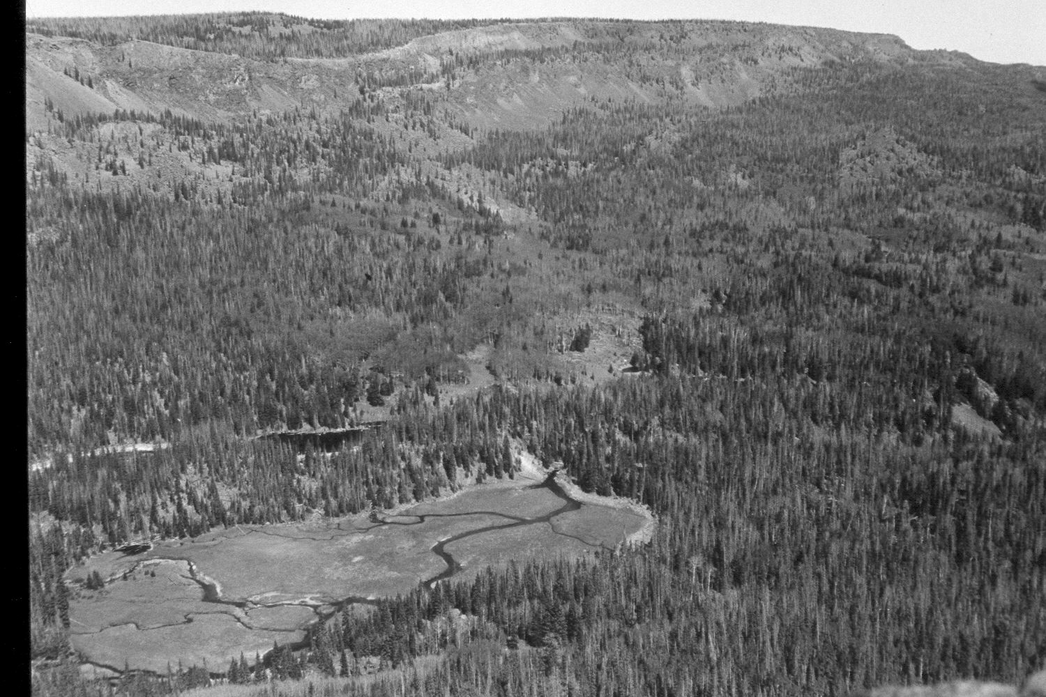
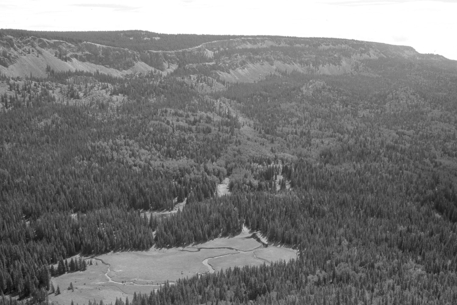
Plate 98X. East Fork of Boulder Creek 1953-2002 Viewed east across the East Fork of Boulder Creek to Boulder Top. The photopoint is on the rim just east of Halfmoon Lake and is the same as that for Plate 97x. Spruce have increased in height, density, and numbers, while aspen has declined. All aspen stands have been heavily invaded by conifers and most have not regenerated in 100 or more years due to excessive herbivory by cattle, elk, and deer. Note the cattle visible in the meadow in the retake. The stream channel pattern in the meadow is largely unchanged, but there appear to be fewer fresh gravel deposits today. Most of these streams are spring fed either in the opening itself or with 400 yards of the meadow. The East Fork of Boulder Creek does not actually flow off Boulder Top except, perhaps, in flood. The two ponds east of the main meadow appear more heavily vegetated, with less open water, in the retake than they did in 1953. This may be a function of the recent drought that has gripped southern Utah for several years, i.e. the water level has been lowered, which has allowed the growth of emergent vegetation. The elevation of the meadow is 9,920 ft.
Photo Information:
U.S. Geological Survey photograph taken by R.G. Luedke (No. 52) ca. 1953; retake by Charles E. Kay on August 5, 2002 - - Photo No. 5010-16. Original photograph held by U.S. Geological Survey Photographic Library, Denver, CO.
Vegetative Community:
Conifer, Aspen, Wet Meadow
Location:
South West: Section 28, Range 4 East, Township 31 South; UTM 458800E, 4214450N; elevation 10,800 ft.