East Creek
1945
2006
Description:
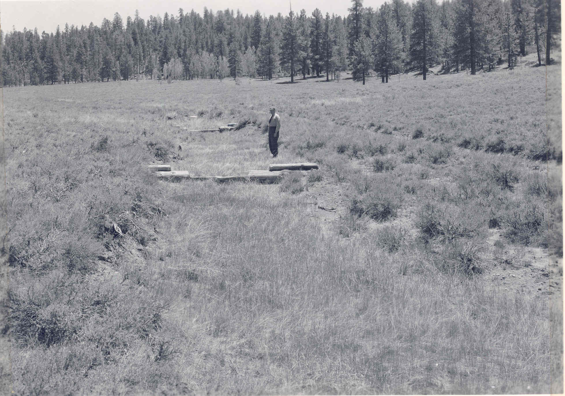
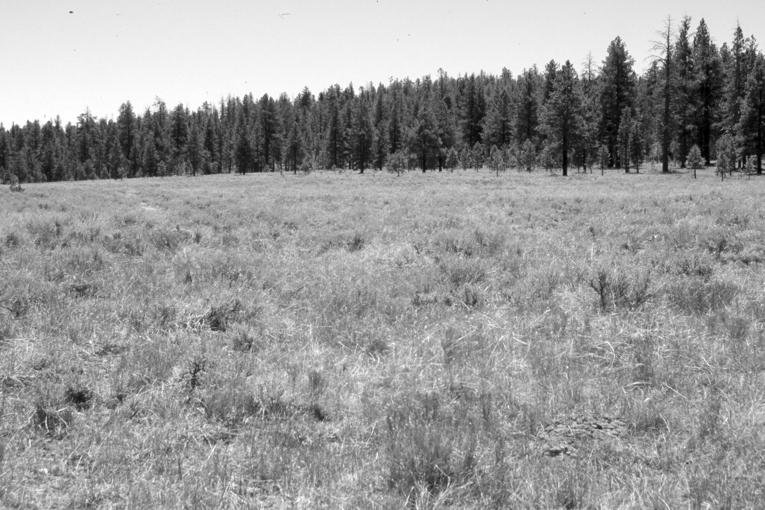
Plate 1265X. East Creek 1945 – 2006 Viewed southeast up the Middle Fork of East Creek in Bryce Canyon National Park. The 1945 image shows a gully that the Park Service had treated in 1935 to control erosion. Wooden check dams were installed and the area reseeded. The check dams have slowly rotted away and there is no sign of recent erosional events. Ponderosa pine has increased despite a number of light surface fires set by the Park Service to restore ecological conditions. Black sage has declined, while native grasses appear to have increased. The road is no longer used and has naturally revegetated.
Photo Information:
Original photograph (Acc. 395, Cat. 3933, Photo 39) taken on June 15, 1945; retake by Charles E. Kay on June 23, 2006 - - Photo No. 5662-33. Original photograph held by the National Park Service, Bryce Canyon National Park, Bryce Canyon, UT.
Vegetative Community:
Conifer, Sagebrush, Dry Meadow
Location:
South West: Section 11, Range 4 West, Township 37 South; UTM 395400 E, 4161750 N; elevation 7,980 ft.