East Creek
1938
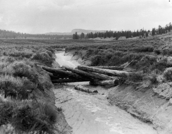
2006
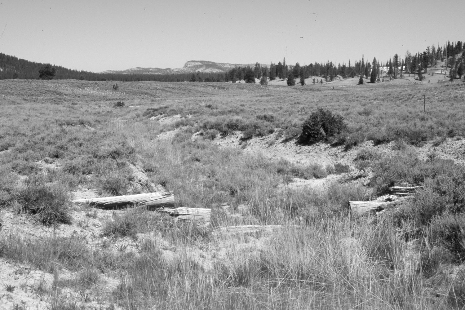
Description:
Plate 1261X. East Creek 1938 – 2006 Viewed northwest down the North Fork of East Creek in Bryce Canyon National Park. Wilson Peak (9,034 ft) is on the skyline. The 1938 image was taken during a storm event and shows flood waters washing out check dams built to combat erosion. According to the original photo caption, 2.30 inches of rain had fallen during a 20 minute storm event. The log structures were rebuilt by the Park Service and today the gully has naturally revegetated. There are no signs of recent erosion. Black sage appears to have declined, while native grasses appear to have increased.
Photo Information:
Original photograph taken by J.C. Anderson (No. 92) in 1938; retake by Charles E. Kay on June 23, 2006 - - Photo No. 5662-16. Original photograph held by the U.S. Geological Survey Photographic Library, Denver, CO.
Vegetative Community:
Sagebrush, Dry Meadow
Location:
South West: Section 11, Range 4 West, Township 37 South; UTM 395000 E, 4162850 N; elevation 7,900 ft.