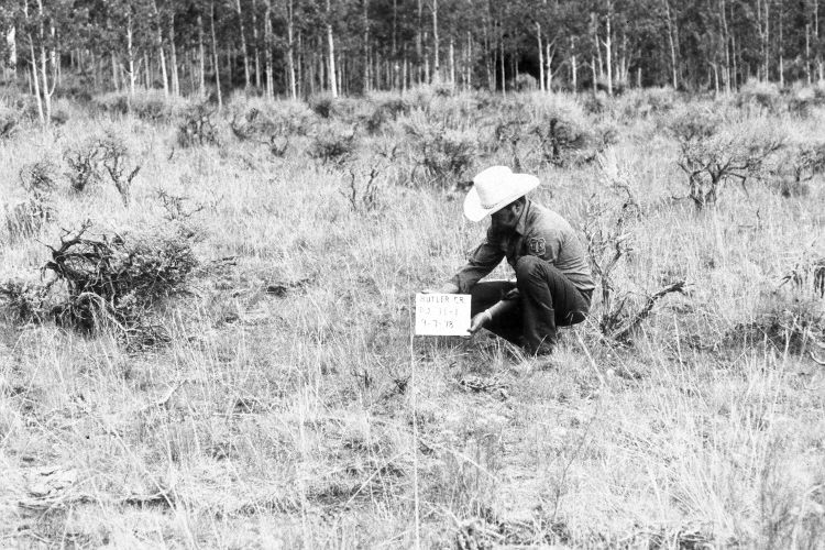
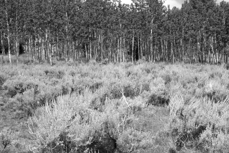
Dry Fork Of Butler Creek
1978
2005
Description:
Plate 1037X. Dry Fork of Butler Creek 1978 – 2005 Viewed northwest along line one of the Parker Three-Step Transect on the Dry Fork of Butler Creek northeast of Panguitch Lake. Mountain big sage has increased, while needle and thread, squirreltail, and Stipa sp. have declined. Some bitterbrush is also present. The aspen stand regenerated 30 years ago when mule deer numbers were low but since that time all the aspen saplings have been highlined by deer and elk (Kay and Bartos 2000). In addition, all aspen suckers have been repeatedly browsed by elk, deer, and cattle preventing further regeneration (Kay and Bartos 2000).
Photo Information:
U.S. Forest Service photograph (unnumbered) taken on September 7, 1978; retake by Charles E. Kay on August 5, 2005 - - Photo No. 5518-11. Original photographs, negatives, and narrative reports held in the range files on the Cedar City Ranger District, Dixie National Forest, Cedar City, UT.
Vegetative Community:
Sagebrush, Aspen, Dry Meadow
Location:
South West: Section 10, Range 7 West, Township 35 South; UTM 357000 E, 4182300 N; elevation 8,680 ft.