Desert Mound
1924
2007
Description:
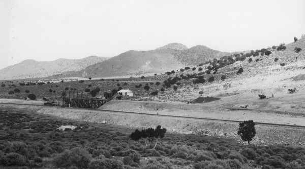
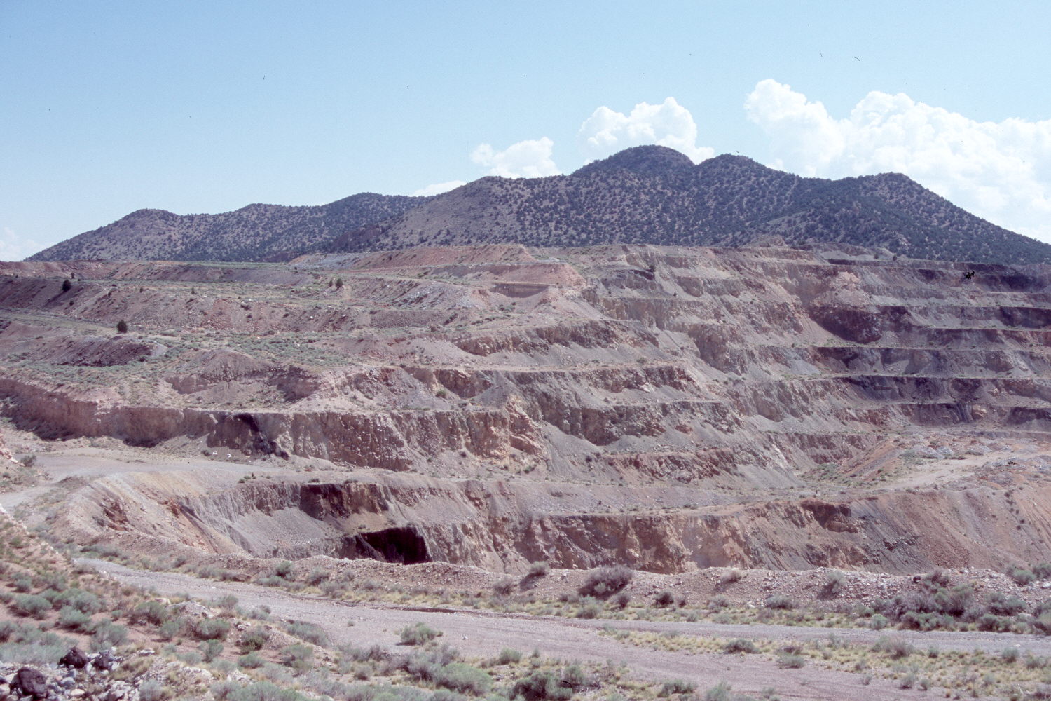
Plate 1473X. Desert Mound 1924 – 2007 Plates 1473x to 1474x form a panorama of Desert Mound northwest of Cedar City, Utah. The horse drawn scrapers seen in the 1924 images have been replaced with an open pit iron mine that is no longer in operation. Plate 1473x is viewed northeast to the Granite Mountains and Swett Peak (6,725 ft.). Pinyon and juniper have increased in the distance and much of the mine spoil has naturally revegetated. A radio tower is now present on the peak furthest to the left. Mining activity has destroyed the original camera station, so the retake was made from a location that afforded the best view of the distant hills. The railroad seen in the 1924 image has been realigned further to the west.
Photo Information:
Original photograph taken by E.J. Burchard (No. 1253) on July 28, 1924; retake by Charles E. Kay on August 18, 2007 - - Photo No. 5823-8A. Original photograph held by the U.S. Geological Survey Photographic Library, Denver, CO.
Vegetative Community:
Pinyon, Juniper
Location:
South West: Section 2, Range 13 West, Township 36 South; UTM 299130 E, 4175646 N; elevation 5,661 ft.