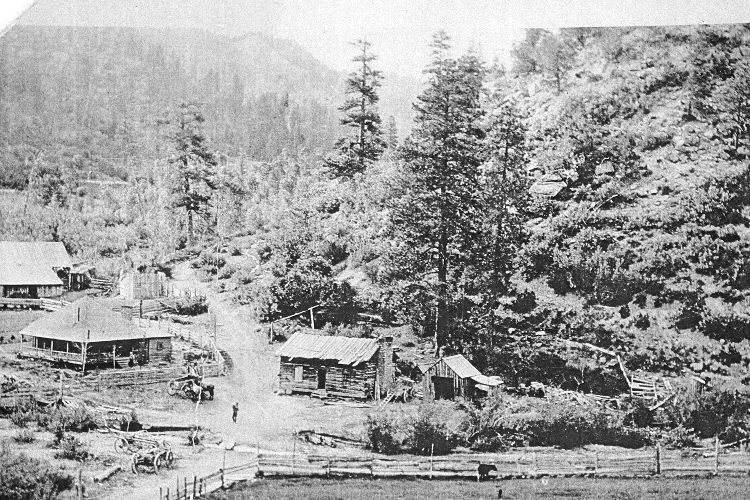
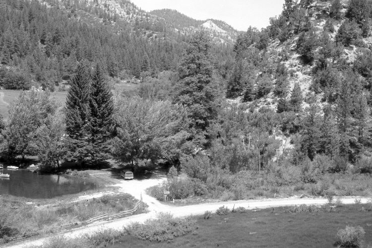
Dairy Canyon
1915
2005
Description:
Plate 888X. Dairy Canyon 1915 – 2005 Viewed northwest up Dairy Canyon. Cottonwoods now block the original photopoint, so the retake was made from the nearest open area, which is further to the north (right). The road from left to right goes up Stout Canyon. Summer homes and fish ponds have been added. Conifers, primarily ponderosa pine have increased, as have pinyon, juniper, oakbrush, bitterbrush, and true mountain mahogany.
Photo Information:
Original photograph taken ca. 1915; retake by Charles E. Kay on June 21, 2005 - - Photo No. 5461-13. Original photograph held by the Kanab Museum, Kanab, UT.
Vegetative Community:
Conifer, Pinyon, Juniper, Oakbrush, Mountain Brush
Location:
South West: Section 13, Range 7 West, Township 39 South; UTM 359500 E, 4142100 N; elevation 6,740 ft.
January 2018