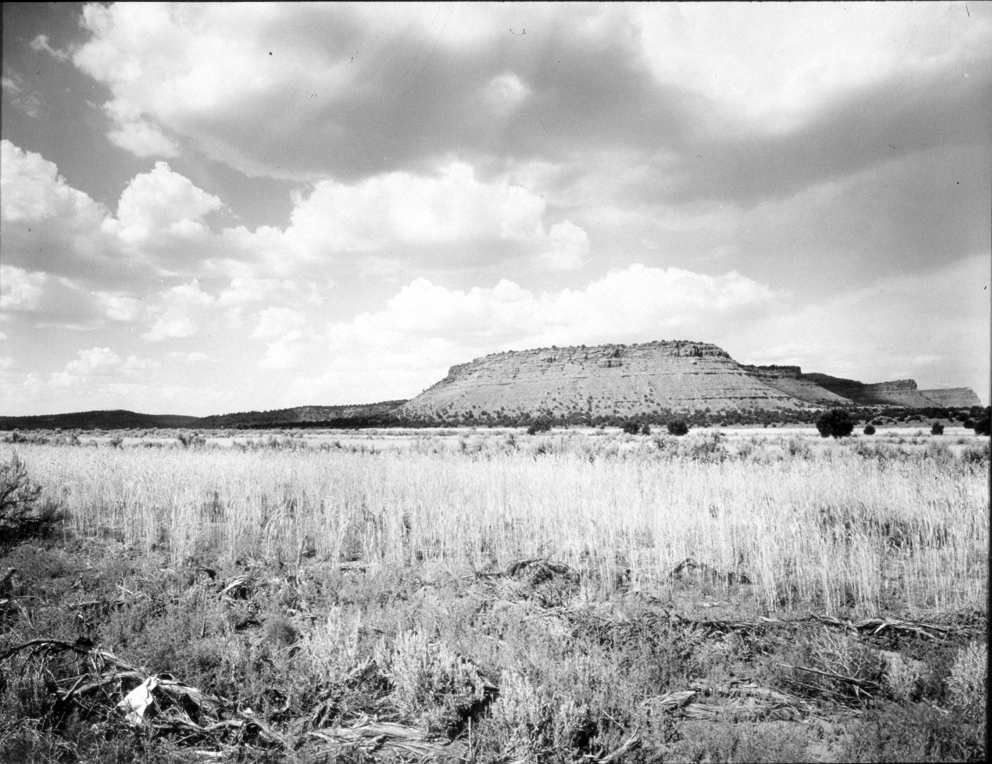
Crescent Butte
1944
2004
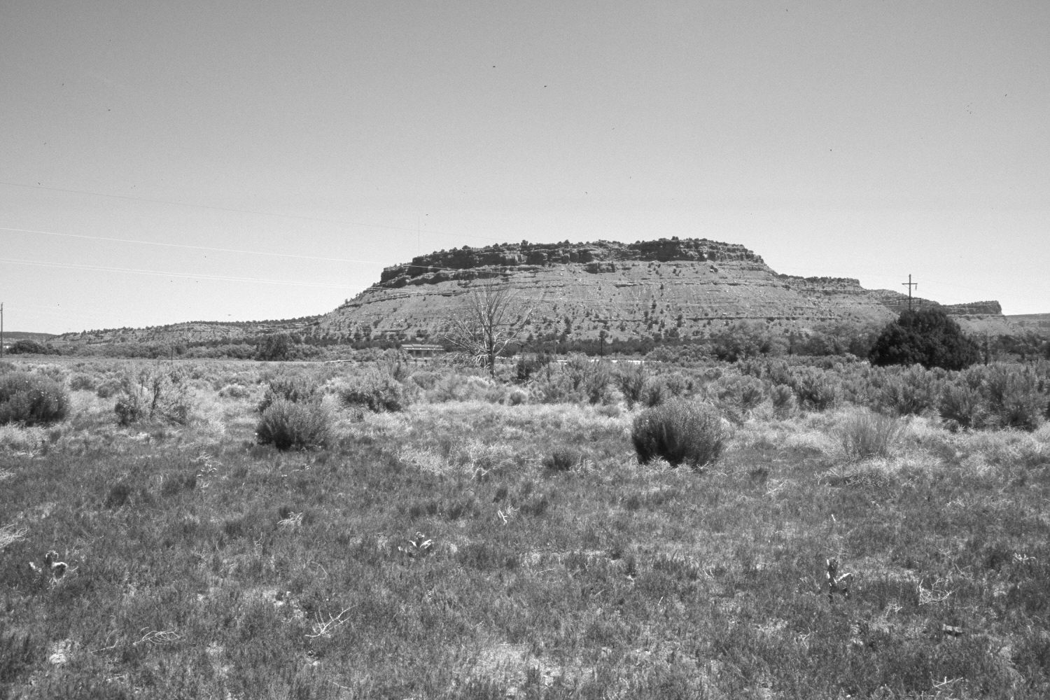
Description:
Plate 481X. Crescent Butte 1944 – 2004 Viewed northeast to Crescent Butte (5,588 ft.) at the mouth of Johnson Canyon east of Kanab, UT. The photopoint is on the old roadway - - U.S. Highway 89 has been rerouted 100 yards to the north and is visible in the retake. Cottonwoods, willows, tamarisk, and Russian olive have increased along Johnson Wash. Pinyon and juniper have also increased. Wyoming big sage, rubber rabbitbrush, and Russian thistle have invaded the former agricultural field in the foreground. Power lines and a new house have been added.
Photo Information:
Original photograph taken by H.E. Gregory (No. 1208) in 1944; retake by Charles E. Kay on June 7, 2004 - - Photo No. 5335-2. Original photograph held in the U.S. Geological Survey Photograph Library, Denver, CO.
Vegetative Community:
Riparian, Pinyon, Juniper, Sagebrush
Location:
South West: Section 30, Range 4½ West, Township 43 South; UTM 379300 E, 4099600 N; elevation 5,100 ft.