Cottonwood Creek Tusher Mountains
1927
2000
Description:
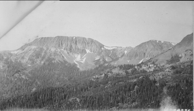
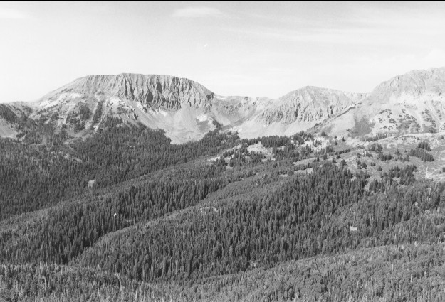
Plate 245. COTTONWOOD CREEK TUSHER MOUNTAINS 1927-2000 Viewed southeast from Alunite Ridge across upper Cottonwood Creek to Mount Holly (11,985 ft). Conifers have increased while aspen has declined. Most aspen stands have been invaded by conifers and aspen has not regenerated in many years.
Photo Information:
U.S. Forest Service photo 224236 taken by C.J. Olsen in July 1927; retake by Charles E. Kay on August 4, 2000 - - Photo No. 4664-17A; Original photo (2310-Fishlake-23) held by Forest Service Regional Office Photographic Collection housed at Weber State University, Ogden, UT.
Vegetative Community:
Conifer, Aspen
Location:
South Central: Section 17, Range 4 W, Township 28 S; UTM 383850 E, 4248350 N; elevation 11,160 ft.
January 2018