Corral Hollow
1965
2005
Description:
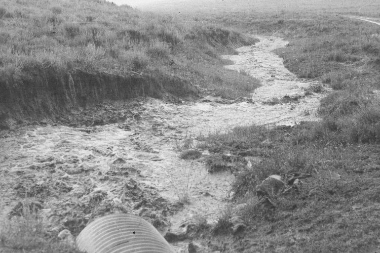
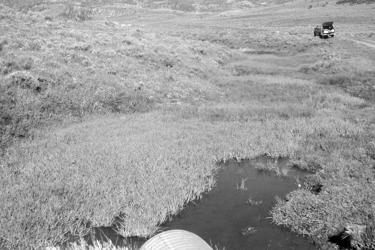
Plate 919X. Corral Hollow 1965 – 2005 Viewed west down Corral Hollow north of Panguitch Lake. Sedges and rushes have increased along the stream, while silver sage appears to have increased on drier sites. The area was actively being grazed by cattle in 2005.
Photo Information:
U.S. Forest Service photograph (unnumbered) taken on August 16, 1965 during a storm event; retake by Charles E. Kay on June 25, 2005 - - Photo No. 5473-32. Original photographs, negatives, and reports held in the range files on the Cedar City Ranger District, Dixie National Forest, Cedar City, UT.
Vegetative Community:
Riparian, Sagebrush
Location:
South West: Section 36, Range 7 West, Township 34 South; UTM 360150 E, 4186650 N; elevation 7,880 ft.
January 2018