Cooper Knoll
1936
2005
Description:
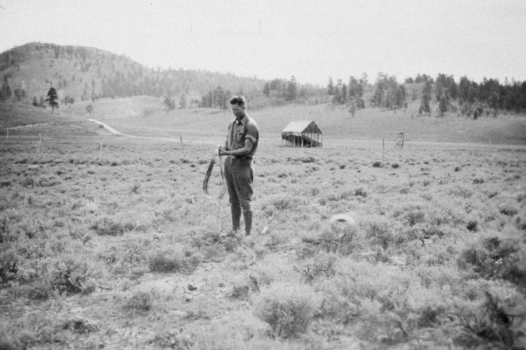
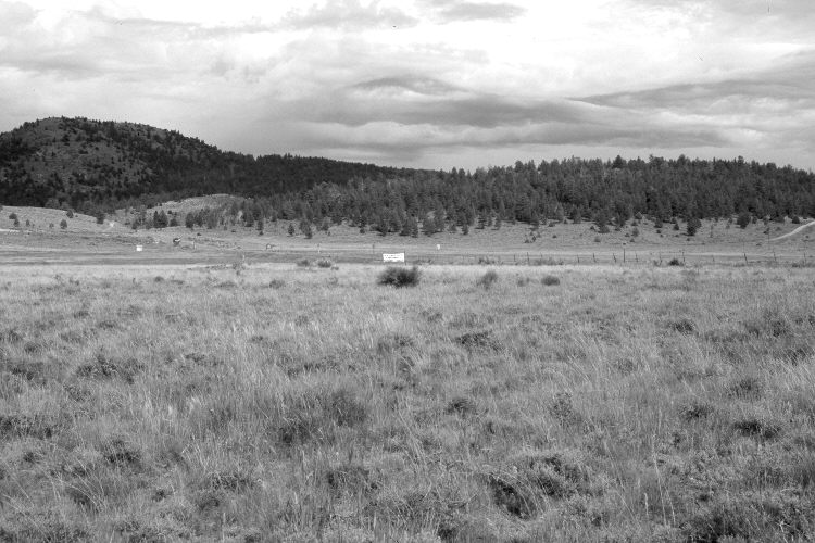
Plate 1027X. Cooper Knoll 1936 – 2005 Viewed southeast with Cooper Knoll (9,015 ft.) on the left skyline. The photopoint is approximately 100 yards north of Utah Highway 143 and just east on the road to Panguitch Lake Resort. The camera station is at the end of the old snow survey course at Panguitch Lake and is still marked with a steel sign post - - see Plate 1023x. In 1936, a series of snow courses were established throughout southern Utah by what is today the Natural Resources Conservation Service (NRCS). When they were first set-up, photographs were taken at each snow survey site. Although the snow course at Panguitch Lake is no longer used by NRCS, the photos remain. Juniper, ponderosa pine, and other conifers have increased in the distance, while aspen has declined. Three-tipped sage, mountain big sage, and rubber rabbitbrush appear to have decreased in the foreground. Needle and thread is the most common native grass. Utah Highway 143 has been realigned, widened, and paved.
Photo Information:
Original photograph (NRCS – 198) taken on September 9, 1936; retake by Charles E. Kay on August 3, 2005 - - Photo No. 5514-10. Original photograph held by the Snow Survey Supervisor, Natural Resources Conservation Service, Salt Lake City, UT.
Vegetative Community:
Juniper, Conifer, Aspen, Sagebrush
Location:
South West: Section 4, Range 7 West, Township 36 South; UTM 355400 E, 4174250 N; elevation 8,240 ft.