From Comb Ridge
1946
1996
Description:
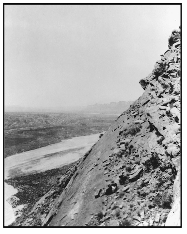
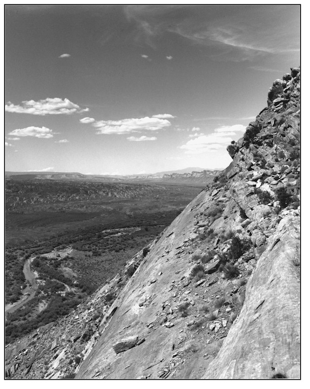
FROM COMB RIDGE Photograph Number: Gregory No. 1946 Original: Date: 1928 (- A) Photographer: H.E. Gregory Source: University of Utah, Special Collections, H.E. Gregory Collection Retake: Date: July 15, 1995 (- B) Photographer: Earl Hindley Source: Bureau of Land Management General Description: This photopoint is on the summit of Comb Ridge about 1/4 mile south of where the 345 KV powerline crosses the ridge. The view is north along Comb Ridge and Wash. The immediate foreground and the lower portion of is a state section with BLM land beyond. The photopoint for Woodruff No.178 is found at mid-photo on the west side of . Legal Description: NW1/4SW1/4 Section 36 T.40S., R.20E. COMPARISON Gregory's 1928 image of shows a wide, shallow and braided channel with little, if any, riparian vegetation. The active channel at the widest point visible in the 1928 photograph is about 1,000 feet across. The 1995 image shows a much narrower single stem channel with several overflow channels. Established vegetation on the second and third terraces in 1995 consists primarily of tamarisk, greasewood, rabbitbrush, a few Fremont cottonwood trees and grass and forb species. Streambanks and the first terrace is occupied by a surprising number of other riparian plant species including coyote willow, Fremont cottonwood seedlings and poles, spikerush, bulrush, saltgrass and scratchgrass. The active visible channel is estimated to be from 20-50 feet wide. is an intermittent stream at this point and riparian vegetation development will be correspondingly slow. However, vegetation diversity, frequency and density along with channel configuration has vastly improved in the 67 years between photographs.
Vegetative Community:
Riparian
Location:
San Juan