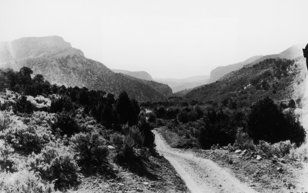
Coal Creek
1920
2006
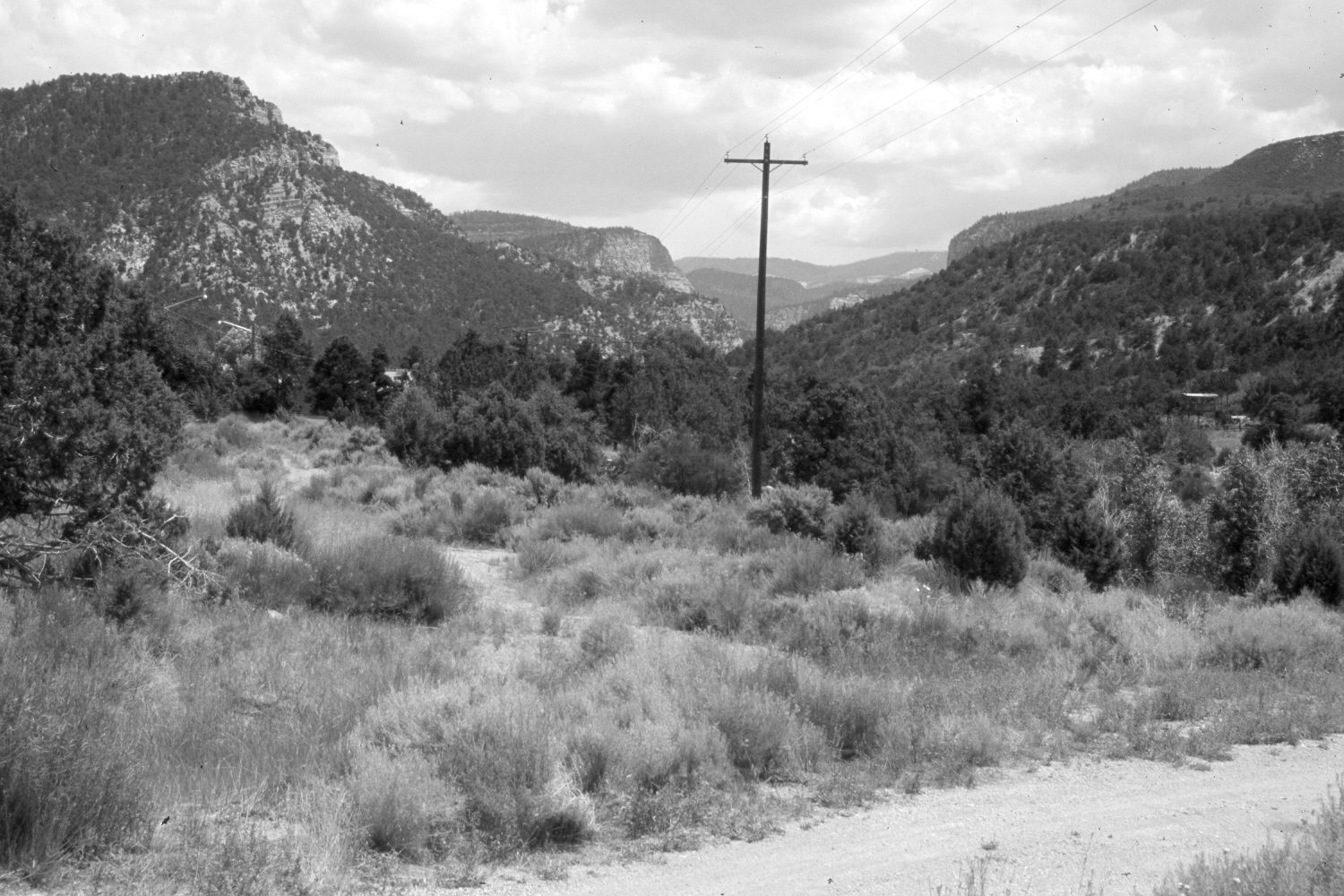
Description:
Plate 1345X. Coal Creek 1920 – 2006 Viewed southeast up Coal Creek east of Cedar City. Utah Highway 14 has been realigned, widened, and paved off the photo to the left. Pinyon and juniper now block the original photopoint, so the retake was made from the nearest open area. Pinyon and juniper have increased, as has woody riparian vegetation along Coal Creek. Oakbrush, conifers, and mountain brush have also increased.
Photo Information:
U.S. Forest Service photograph (150418) taken by Shipp in 1920; retake by Charles E. Kay on July 17, 2006 - - Photo No. 5695-30. Original photograph (095-G-150418) held in the National Archives, Washington D.C.
Vegetative Community:
Riparian, Pinyon, Juniper, Conifer, Mountain Brush
Location:
South West: Section 24, Range 10 West, Township 36 South; UTM 324800 E, 4168975 N; elevation 6,510 ft.