Clay Flats Knoll
1912
1996
Description:
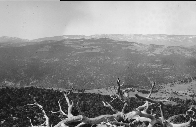
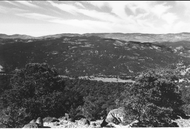
Plate 34. CLAY FLATS KNOLL: 1912 - 1996 This view shows Last Chance Creek with the Fishlake Plateau in the distance. The dead pinyon (Pinus edulis) in the foreground was apparently placed there for photographic effect. Pinyons in the foreground have grown over the years, but the pinyon and juniper (Juniperus sp.) on the hillside in lower left-center of the photo appear little changed. The open hillside and grasslands at right-center have been heavily invaded by pinyon-juniper by 1996. The same is true on the more distant hillsides where pinyon-juniper has increased in height and density and has invaded former grassy areas. Conifers on the Fishlake Plateau also appear to have increased at the expense of aspen (Populus tremuloides). Together with Plates 33 and 35, this forms a panorama from south to northwest.
Photo Information:
1912 photo [#329] taken by Lupton; 1996 photo is Kay #4064-14, taken on Sept, 20. Lupton’s photo held by U.S. Geological Survey Photographic Archives, Denver, CO
Vegetative Community:
Pinyon, Juniper, Conifer, Aspen
Location:
South Central: Last Chance Creek, T24S, R5E., Sect. 33, UTM 4280300 N, 468300 E; elevation 8,055 ft.; view to west-southwest.