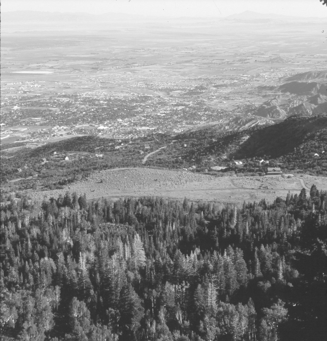
Cedar City
1925
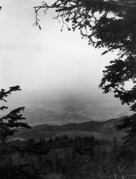
2006
Description:
Plate 1322X. Cedar City 1925 – 2006 Viewed northwest to Cedar City from Lone Tree Mountain. Conifers now block the original camera station, so the retake was made from the nearest open area on the Kolob Reservoir Road. Spruce, white fir, Douglas fir, pinyon, juniper, and oakbrush have all increased, while aspen has declined. New roads and homes have been built. Coal Creek in the distance is more vegetated today than it was in the past.
Photo Information:
Original photograph taken by W.H. Bradley (No. 122) on June 15, 1925; retake by Charles E. Kay on July 14, 2006 - - Photo No. 5689-3. Original photograph held by the U.S. Geological Survey Photographic Library, Denver, CO.
Vegetative Community:
Conifer, Pinyon, Juniper, Aspen
Location:
South West: Section 36, Range 11 West, Township 36 South; UTM 320300 E, 4165700 N; elevation 8,800 ft.