Cedar Canyon
1906
2006
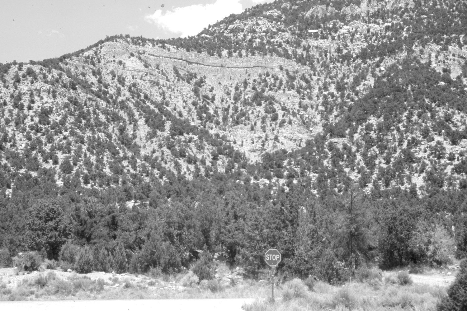
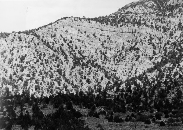
Description:
Plate 1348X. Cedar Canyon 1906 – 2006 Viewed north at the Utah Highway 14 – Cedar Mountain road junction in Cedar Canyon. Pinyon and juniper now block the original camera station, so the retake was made from the nearest open area. Pinyon and juniper have increased.
Photo Information:
Original photograph taken by Lee (No. 227) in 1906; retake by Charles E. Kay on July 17, 2006 - - Photo No. 5697-8. Original photograph held by the U.S. Geological Survey Photographic Library, Denver, CO.
Vegetative Community:
Pinyon, Juniper
Location:
South West: Section 24, Range 10 West, Township 36 South; UTM 324800 E, 4168975 N; elevation 6,510 ft.
January 2018