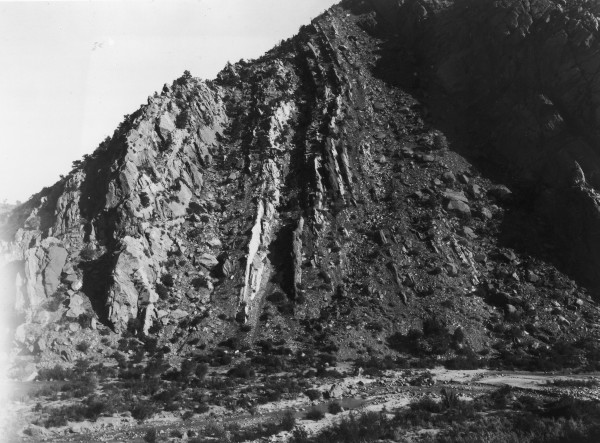
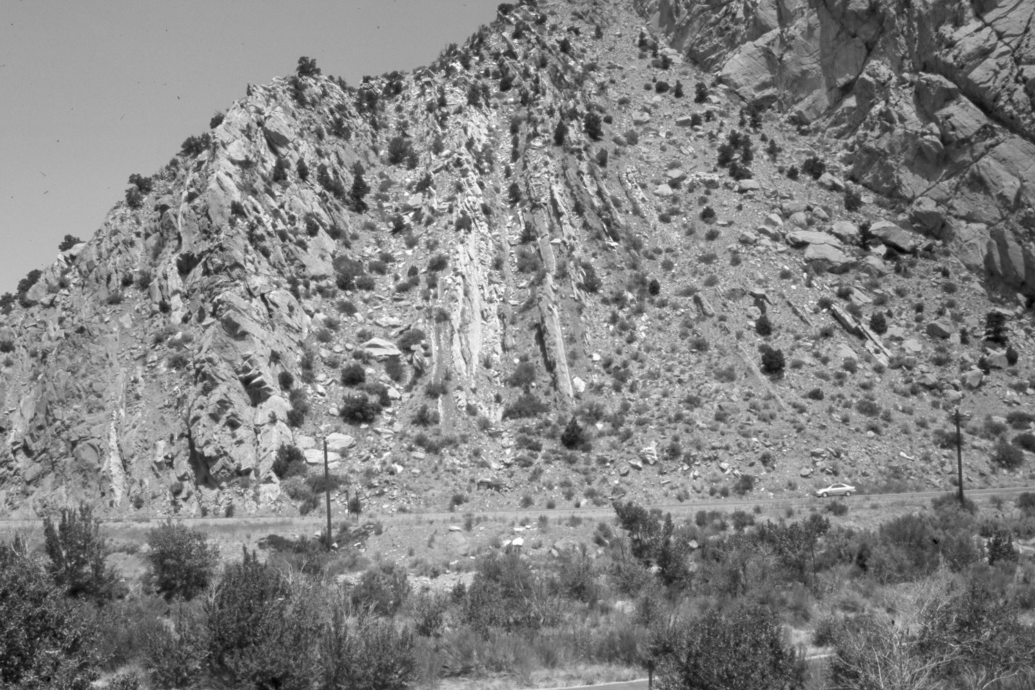
Cedar Canyon
1906
2006
Description:
Plate 1342X. Cedar Canyon 1906 – 2006 Viewed north to Red Hill at the mouth of Cedar Canyon. Pinyon and juniper now block the original camera station, so the retake was made from the nearest open area. Coal Creek is more vegetated today than it was in the past. A bike path has recently been constructed on the south side of the canyon, while Utah Highway 14 has been built on the north side of the stream. There has been a slight increase in pinyon and juniper on the steep, south-facing canyon wall.
Photo Information:
Original photograph taken by Lee (No. 226) in 1906; retake by Charles E. Kay on July 17, 2006 - - Photo No. 5695-21. Original photograph held by the U.S. Geological Survey Photographic Library, Denver, CO.
Vegetative Community:
Riparian, Pinyon, Juniper
Location:
South West: Section 13, Range 11 West, Township 36 South; UTM 320300 E, 4170950 N; elevation 6,000 ft.