Cedar Breaks National Monument
1936
2005
Description:
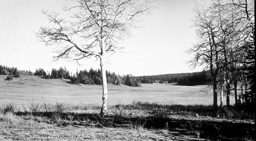
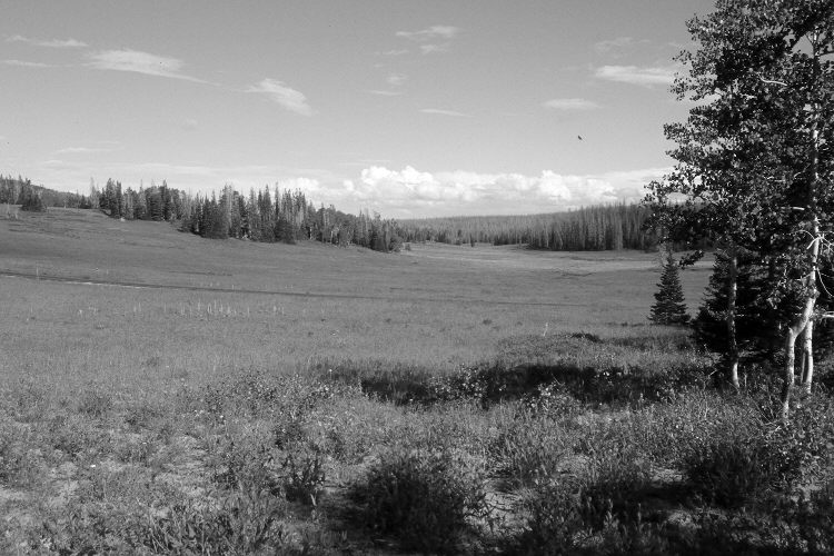
Plate 1134X. Cedar Breaks National Monument 1936 – 2005 Viewed southeast down an upper fork of Mammoth Creek in Cedar Breaks National Monument. Spruce has increased, while aspen has declined. Many of the older spruce, though, were recently killed by insects and disease. Some aspen, however, regenerated about 30 years ago when mule deer numbers were low, but not before or since due to repeated ungulate browsing (Kay and Bartos 2000). The fence in the distance is the boundary of the National Monument. Forbs and grasses have increased in the foreground, as it has not been grazed by livestock for many years. Utah Highway 148 is visible in the retake. The shrubs on the left hillside are currants, while silver sage can be found in other parts of the meadow.
Photo Information:
Original photograph taken by J.C. Anderson (No. 42) in 1936; retake by Charles E. Kay on September 4, 2005 - - Photo No. 5562-3A. Original photograph held by the U.S. Geological Survey Photographic Library, Denver, CO.
Vegetative Community:
Conifer, Aspen
Location:
South West: Section 36, Range 9 West, Township 36 South; UTM 338350 E, 4166350 N; elevation 10,520 ft.