Calf Pasture Hollow
1933
2004
Description:
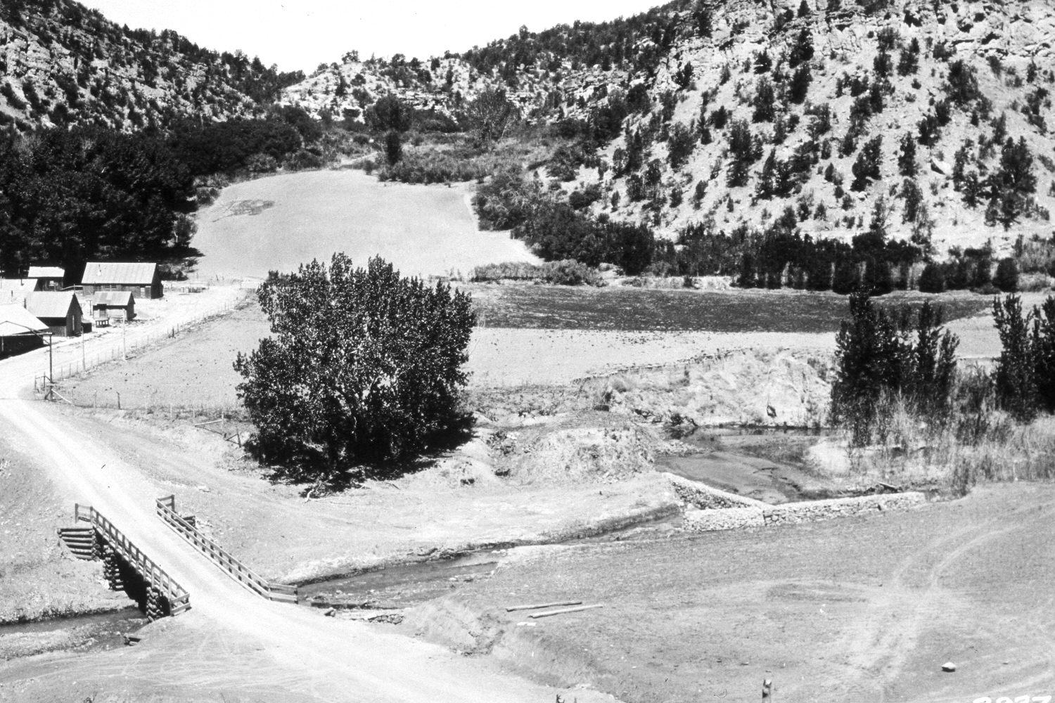
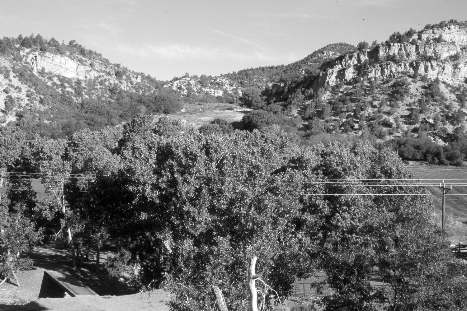
Plate 536X. Calf Pasture Hollow 1933 – 2004 Viewed west up Calf Pasture Hollow to the old CCC camp above Orderville, UT. The East Fork of the Virgin River flows from right to left. The original photograph was taken from the old roadway, while the retake was taken from the present alignment of U.S. Highway 89, which is approximately 40 feet higher. This was necessary as cottonwood trees now block the original view. Cottonwoods and other woody riparian vegetation have increased despite yearly livestock grazing on this private pasture. Pinyon and juniper have increased, while oakbrush has thickened. The area between the camera and the river is now used as a stock holding area.
Photo Information:
U.S. Forest Service photograph (293741) taken by Reed W. Bailey in 1933; retake by Charles E. Kay on July 1, 2004 - - Photo No. 5356-21. Original photograph held by the Utah Historical Society, Reed W. Bailey Collection (Box 7), Salt Lake City, UT.
Vegetative Community:
Riparian, Pinyon, Juniper, Oakbrush
Location:
South West: Section 34, Range 7 West, Township 40 South; UTM 356400 E, 4127800 N; elevation 5,560 ft.