Calf Creek
ca. 1930
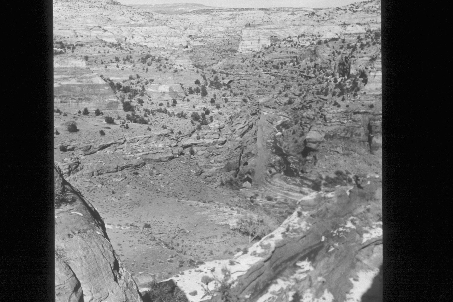
2002
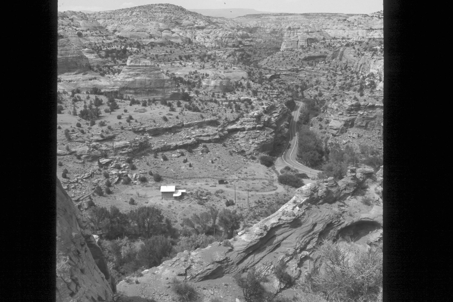
Description:
Plate 56X. Calf Creek ca. 1930-2002 Viewed north up Calf Creek from east of the Escalante River Overlook on Utah Highway 12. The CCC barracks and gravel road up Calf Creek are visible in the original. Note the absence of woody vegetation in the original and how conditions have improved today. Most of the plants are willows and cottonwoods. Very little tamarisk is present. Pinyon and juniper have also increased.
Photo Information:
U.S. Forest Service photograph (unnumbered) taken ca. 1930; retake by Charles E. Kay on July 10, 2002 - - Photo No. 4973-31. Original photograph held by Southern Utah University Archives and Special Collections, Cedar City, UT.
Vegetative Community:
Riparian, Pinyon, Juniper
Location:
South West: Section 12, Range 4 East, Township 35 South; UTM 463000E, 4180400N; elevation 5,560 ft.