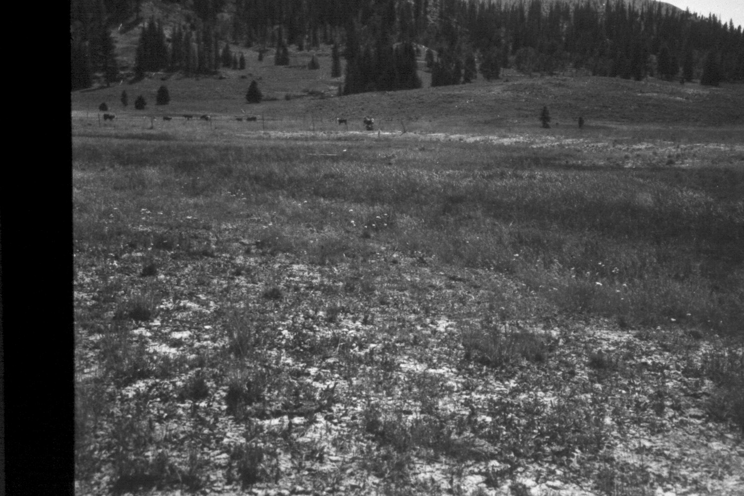
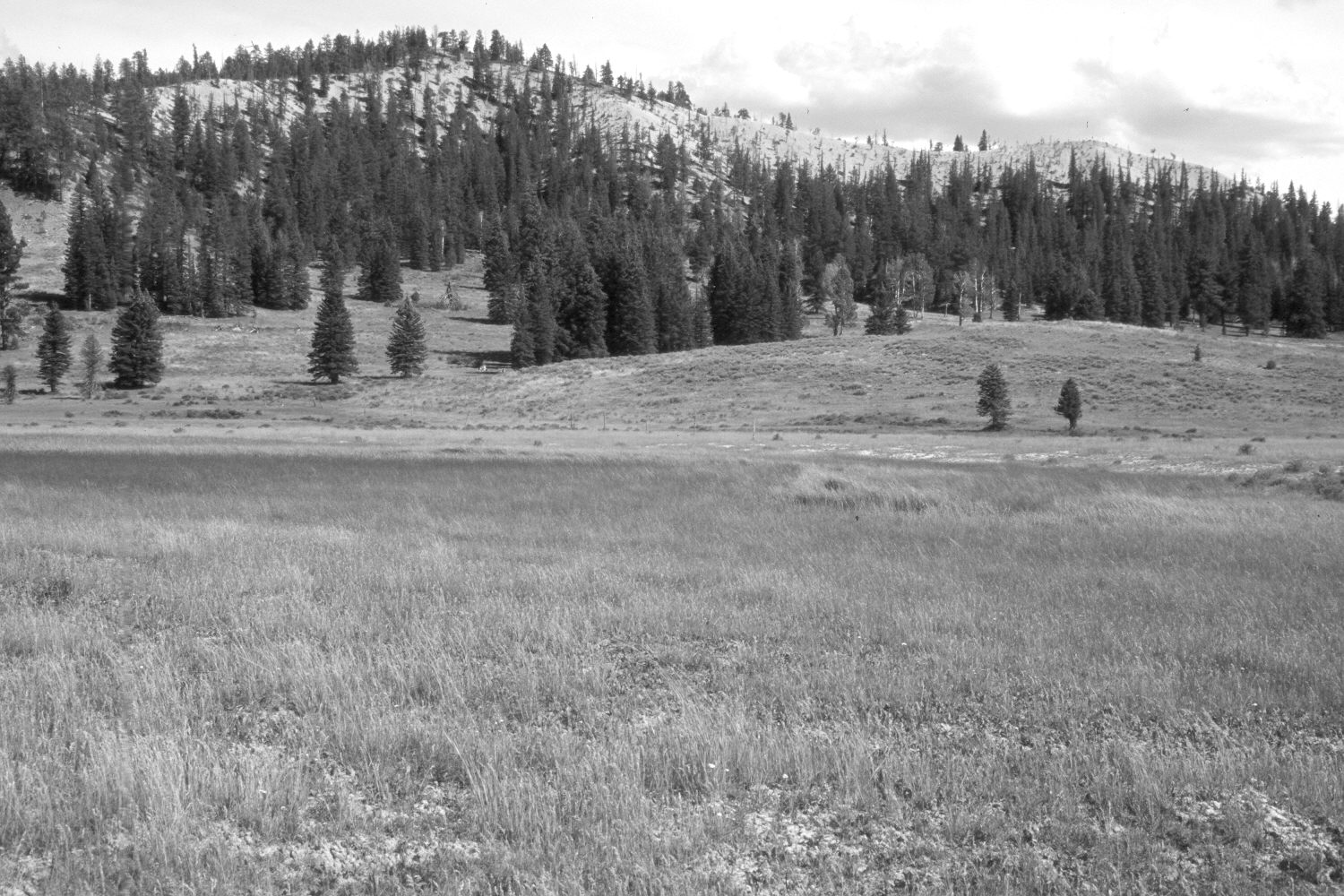
Buck Knoll
1964
2003
Description:
Plate 281X. Buck Knoll 1964 - 2003 Viewed southeast across Blubber Creek to Buck Knoll on the Paunsaugunt Plateau. Despite selective logging, spruce and ponderosa pine have increased, but aspen has declined. The shrubs in the meadow are mostly shrubby cinquefoil, while mountain big sage is found on the drier hillsides. Kentucky bluegrass and intermediate wheatgrass are common on the drier parts of the meadow, while sedges and rushes dominate the wetter areas along the stream. The area had not been grazed by livestock in 2003 when the photopoint was revisited.
Photo Information:
U.S. Forest Service photograph (unnumbered) taken by G. Glad Quilter in 1964; retake by Charles E. Kay on August 6, 2003 - - Photo No. 5223-31. Original photograph held in the range files on the Panguitch Ranger District, Dixie National Forest, Panguitch, UT
Vegetative Community:
Conifer, Aspen, Sagebrush, Dry Meadow, Riparian
Location:
South West: Section 35, Range 4½ West, Township 37 South; UTM 385250E, 4156100 N; elevation 8,030 ft.