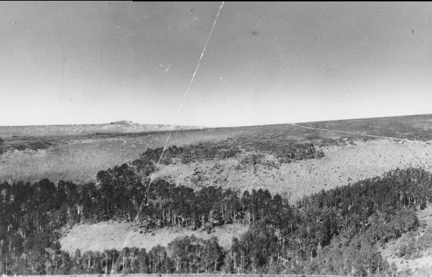
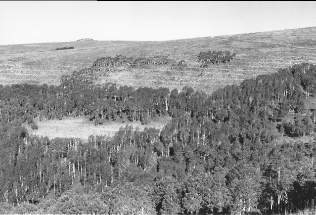
Broad Canyon
1945
1999
Description:
Plate 106. BROAD CANYON: 1945 - 1999 The view is over the head of Broad Canyon to Jacks Peak. This photo set is similar to Plate 105 except the lighting conditions are different in the 1945 photo and more clearly show the active soil erosion below Jacks Peak. The area was later contour trenched and seeded. Aspen (Populus tremuloides) is taller in 1999 than in the 1945 photo, but it has not regenerated.
Photo Information:
1945 photo taken by the U.S. Forest Service; 1999 photo is Kay #4490-14A, taken on Sept. 5. Forest Service photo held by the Fillmore Ranger District, Fishlake National Forest, Fillmore, UT
Vegetative Community:
Aspen, Sagebrush, Mountain Brush
Location:
South Central: North Fork of Chalk Creek, Fishlake National Forest, Fillmore Ranger District, T21S, R2.5W, Sect. 15, UTM 4315200 N, 402350 E; elevation 9,600 ft., viewed to northwest.