Brian Head
1938
2005
Description:
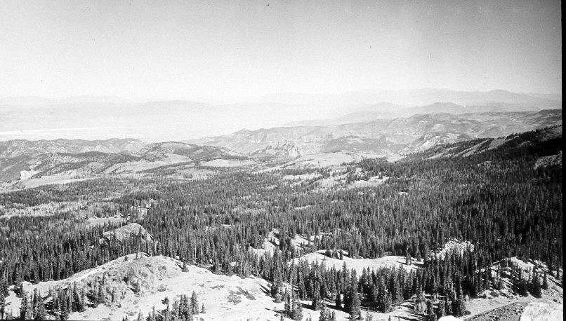
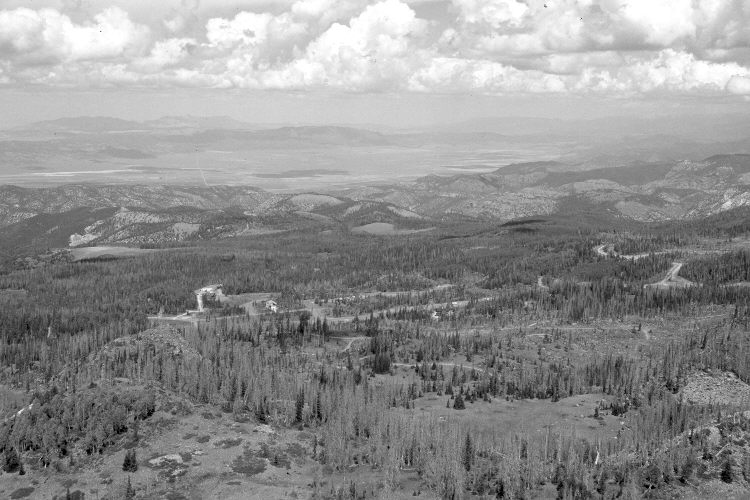
Plate 1127X. Brian Head 1938 – 2005 Viewed northwest from Brian Head. Plates 1126x, 1127x, and 1128x form a panorama. Many of the mature spruce have recently been killed by insects and disease, and some have been salvaged logged. The new road and buildings are part of the Brian Head ski development. In the distance, conifers, pinyon, and juniper have increased, while aspen has declined.
Photo Information:
Original photograph taken by J.C. Anderson (No. 94b) in 1938; retake by Charles E. Kay on September 4, 2005 - - Photo No. 5558-7. Original photograph held by the U.S. Geological Survey Photographic Library, Denver, CO.
Vegetative Community:
Conifer, Pinyon, Juniper, Aspen
Location:
South West: Section 12, Range 9 West, Township 36 South; UTM 338700 E, 4171900 N; elevation 11,300 ft.
January 2018