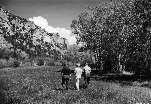
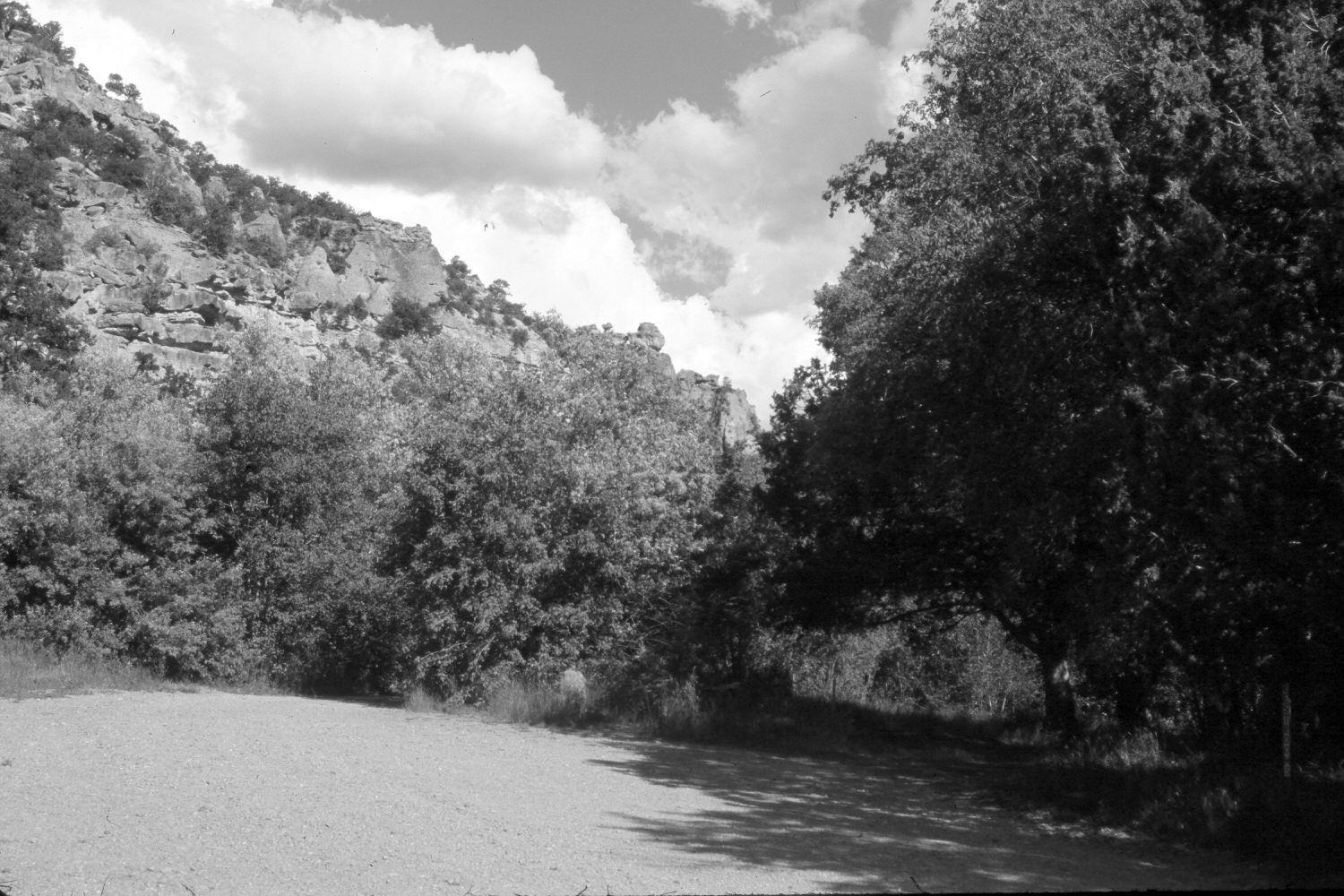
Bowery Creek
1941
2006
Description:
Plate 1387X. Bowery Creek 1941 – 2006 Viewed east up Bowery Creek in First Left Hand Canyon south of Parowan, Utah. Woody vegetation now blocks the original camera station, so the retake was made from the nearest open area. The site is now part of the Vermillion Castle Picnic Area. Willows, cottonwoods, and other woody riparian vegetation have increased, replacing the former wet meadow. In the distance pinyon, juniper, and conifers have increased.
Photo Information:
U.S. Forest Service photograph (410791) taken by Paul S. Bieler in Juner 1941; retake by Charles E. Kay on August 5, 2006 - - Photo No. 5715-4. Original photograph held by Southern Utah University Archives and Special Collections, Cedar City, UT.
Vegetative Community:
Riparian, Wet Meadow, Pinyon, Juniper, Conifer
Location:
South West: Section 6, Range 8 West, Township 35 South; UTM 342100 E, 4184200 N; elevation 6,900 ft.