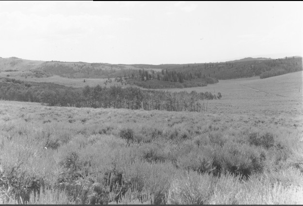
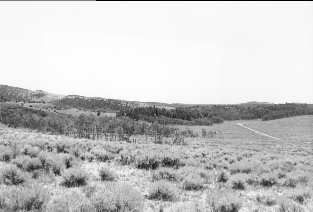
Boundary Flat
1962
2000
Description:
Plate 202. BOUNDARY FLAT 1962-2000 Viewed southeast from USFS Road 046 just after it leaves Utah Highway 25 southwest of Fish Lake. Sagebrush appears unchanged, but aspen has declined and has not regenerated due to excessive browsing. Conifers have increased as has curlleaf mountain mahogany (photo left center edge). The powerline seen in the original has been rerouted.
Photo Information:
U.S. Forest Service photo (unnumbered) taken in 1962; retake by Charles E. Kay on July 28, 2000 - - Photo No. 4643-9; Original photo held by Loa Ranger District, Fishlake National Forest, Loa, UT.
Vegetative Community:
Sagebrush, Aspen, Conifer, Mountain Brush
Location:
South Central: Section 35, Range 1 E, Township 26 S; UTM 432600 E, 4264850 N; elevation 8,980 ft.
January 2018