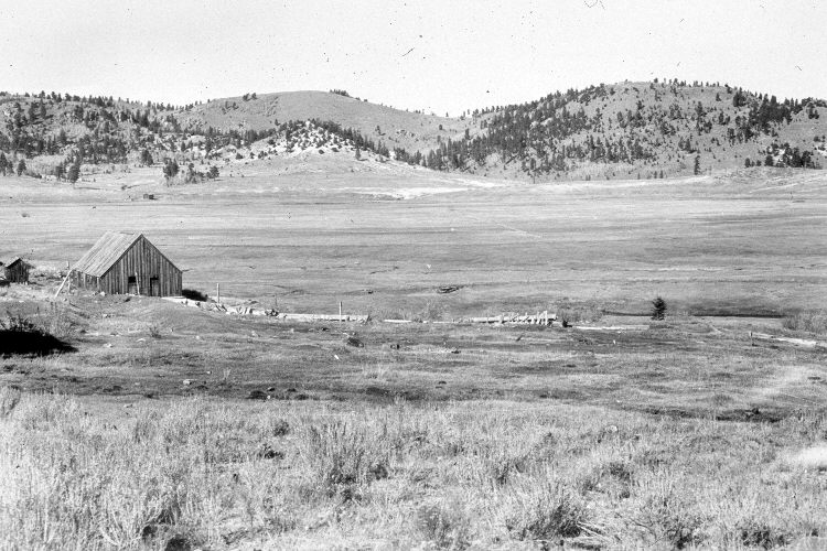
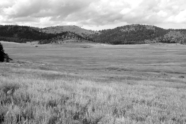
Blue Spring Valley
1944
2005
Description:
Plate 1002X. Blue Spring Valley 1944 – 2005 Viewed north across Blue Spring Valley southwest of Panguitch Lake. The barn is gone. The building on the far left, though, is still standing but is largely hidden from view by spruce. The meadow was actively being grazed by cattle in 2005. Ponderosa pine and juniper have increased on the distant hills, while aspen has declined. Some aspen clones, however, regenerated 30 years ago when deer numbers fell, but not before or since due to repeated ungulate herbivory (Kay and Bartos 2000). Mountain big sage, currant, bitterbrush, and snowberry are the most common shrubs on the far slopes. Plates 1002x to 1006x were made from the same camera station, which is on private property.
Photo Information:
Original photograph taken by H.E. Gregory (No. 1252) in 1944; retake by Charles E. Kay on August 1, 2005 - - Photo No. 5504-4. Original photograph held by the U.S. Geological Survey Photographic Library, Denver, CO.
Vegetative Community:
Dry Meadow, Conifer, Juniper, Aspen, Sagebrush, Mountain Brush
Location:
South West: Section 18, Range 7 West, Township 36 South; UTM 352300 E, 4171800 N; elevation 8,480 ft.