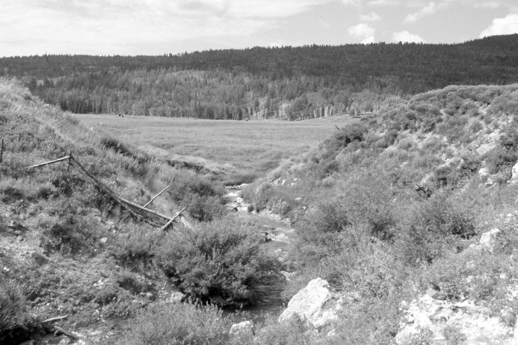
Blue Spring Creek
1968
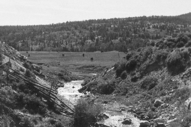
2005
Description:
Plate 1013X. Blue Spring Creek 1968 – 2005 Viewed southwest up Blue Spring Creek where it exits Blue Spring Valley southwest of Panguitch, Utah. Blue Spring Mountain (9,890 ft.) is on the skyline. Although the stream is on bedrock at this location, willows have increased and the banks are more vegetated today than they were in 1968. In the distance, conifers have increased, while aspen has declined. The shrubs in the foreground are mostly mountain big sage, currant, and green rabbitbrush. The area was actively being grazed by cattle in 2005.
Photo Information:
U.S. Forest Service photograph (unnumbered) taken in September 1968; retake by Charles E. Kay on August 2, 2005 - - Photo No. 5506-33A. Original photographs, negatives, and narrative reports held in the range files on the Cedar City Ranger District, Dixie National Forest, Cedar City, UT.
Vegetative Community:
Riparian, Conifer, Aspen, Sagebrush
Location:
South West: Section 7, Range 7 West, Township 36 South; UTM 352350 E, 4173200 N; elevation 8,400 ft.