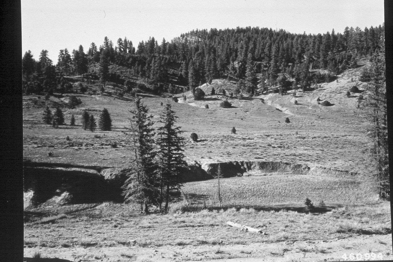
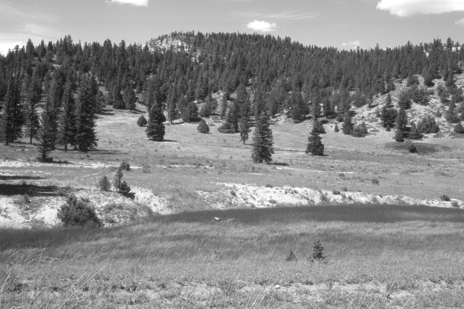
Blubber Creek
1950
2003
Description:
Plate 280X. Blubber Creek 1950 - 2003 Viewed north across Blubber Creek on the Paunsaugunt Plateau. The old logging road in the foreground has not been used in many years and has been revegetated. The spruce trees between the camera and the stream have died and fallen. Despite repeated logging, spruce, ponderosa pine, and juniper have increased on the distant hillside. The stream channel appears more heavily vegetated today than it did in the original image. The area across the creek has been contour-trenched and reseeded by the Forest Service to control erosion. The most common planted grass is intermediate wheatgrass, while native rushes and sedges line the stream. The low shrubs are mostly rubber rabbitbrush and shrubby cinquefoil.
Photo Information:
U.S. Forest Service photograph (460994) taken on April 24, 1950; retake by Charles E. Kay on August 6, 2003 - - Photo No. 5223-24. Original photograph held by the Utah Historical Society, Reed W. Bailey Collection (Box 11), Salt Lake City, UT.
Vegetative Community:
Conifer, Juniper, Riparian, Dry Meadow
Location:
South West: Section 36, Range 4½ West, Township 37 South; UTM 386150E, 4156400 N; elevation 8,000 ft.