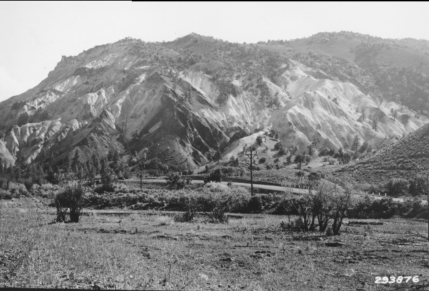
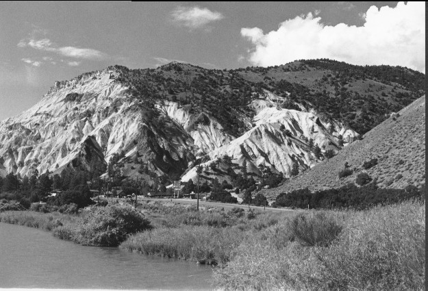
Big Rock Candy Mountain
1934
1999
Description:
Plate 70. BIG ROCK CANDY MOUNTAIN: 1934 - 1999 This photo set is similar to Plate 69. U.S. Highway 89 is visible in both photos. The foreground is private and was heavily grazed in 1934, but not in 1999. The original photo point could not be relocated because the Sevier River channel has changed. Ponderosa pine (Pinus ponderosa) at the base of the mountain appears largely unchanged between the two photos; however pinyon (Pinus edulis) and juniper (Juniperus sp.) have increased over the years above the eroded area.
Photo Information:
1934 photo taken by U.S. Forest Service #293876; 1999 photo is Kay #4456-23, taken on July 27. Forest Service photo held by the Utah Historical Society, Reed W. Bailey Collection, Salt Lake City, UT
Vegetative Community:
Riparian, Conifer, Pinyon, Juniper
Location:
South Central: T26S, R4W, Sect.20, UTM 1264000 N, 389750 E; elevation 5,600 ft., viewed southwest toward Big Rock Candy Mountain.